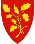
Stord
Appearance
Stord kommune | |
|---|---|
 View of the town of Leirvik | |
 Stord within Vestland | |
| Coordinates: 59°48′29″N 05°27′59″E / 59.80806°N 5.46639°E | |
| Country | Norway |
| County | Vestland |
| District | Sunnhordland |
| Established | 1 Jan 1838 |
| Administrative centre | Leirvik |
| Area | |
| • Total | 143.73 km2 (55.49 sq mi) |
| • Land | 137.45 km2 (53.07 sq mi) |
| • Water | 6.28 km2 (2.42 sq mi) 4.4% |
| • Rank | 316 in Norway |
| Population (2020) | |
| • Total | 18,759 |
| • Rank | 68 in Norway |
| • Density | 136.5/km2 (354/sq mi) |
| • Change (10 years) | 6.8% |
| Demonym(s) | Stordabu, Stording[1] |
| Time zone | UTC+01:00 (CET) |
| • Summer (DST) | UTC+02:00 (CEST) |
| ISO 3166 code | NO-4614 |
| Official language form | Nynorsk[2] |
| Website | stord |
Stord is a municipality in Vestland county, Norway. It is located in the traditional district of Sunnhordland. Stord is the 68th most populous municipality in Norway with a population of 18,759.[3][4]
Related pages
[change | change source]References
[change | change source]- ↑ "Navn på steder og personer: Innbyggjarnamn" (in Norwegian). Språkrådet.
- ↑ "Forskrift om målvedtak i kommunar og fylkeskommunar" (in Norwegian). Lovdata.no.
- ↑ Statistisk sentralbyrå (2020). "Table: 06913: Population 1 January and population changes during the calendar year (M)" (in Norwegian).
- ↑ Statistisk sentralbyrå (2020). "09280: Area of land and fresh water (km²) (M)" (in Norwegian).

