Category:Jacques-Nicolas Bellin
Jump to navigation
Jump to search
French hydrographer, geographer and member of the philosophes | |||||
| Upload media | |||||
| Name in native language |
| ||||
|---|---|---|---|---|---|
| Date of birth | 1703 Paris | ||||
| Date of death | 21 March 1772 Versailles | ||||
| Country of citizenship | |||||
| Occupation | |||||
| Member of |
| ||||
| Award received | |||||
| |||||
Subcategories
This category has the following 4 subcategories, out of 4 total.
Pages in category "Jacques-Nicolas Bellin"
The following 2 pages are in this category, out of 2 total.
Media in category "Jacques-Nicolas Bellin"
The following 90 files are in this category, out of 90 total.
-
1 BALSE, DANS TOUTES SES PROPORTIONS. Colección Johnny Schuler..jpg 4,015 × 5,078; 4.84 MB
-
1750 Bellin Map of Cape Town, South Africa - Geographicus - Gundriss-bellin-1750.jpg 3,375 × 2,722; 1.45 MB
-
1750 Bellin Map of the Kuril Islands - Geographicus - Kouriles-bellin-1750.jpg 3,000 × 2,737; 2.35 MB
-
1750 Bellin Map of the Senegal - Geographicus - Senegal-bellin-1750.jpg 1,985 × 2,784; 1.13 MB
-
1754 Bellin Map of Mexico City ^ Environs - Geographicus - MexicoCity2-bellin-1754.jpg 2,095 × 2,508; 1.03 MB
-
1754 Bellin Map of Veracruz, Mexico - Geographicus - Veracruz-bellin-1754.jpg 1,844 × 2,500; 1.34 MB
-
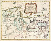
1755 Bellin Map of the Great Lakes - Geographicus - GreatLakes-bellin-1755.jpg 4,000 × 3,215; 3.49 MB
-
1756 Bellin Map of Boston, Massachusetts - Geographicus - Boston-bellin-1756.jpg 3,334 × 2,100; 2.07 MB
-
1756 Bellin Map of Boston, Massachusetts - Geographicus - Boston2-bellin-1756.jpg 2,500 × 1,554; 1.12 MB
-
1756 Bellin Map of Kollam Fort, Kerala, India - Geographicus - Coylan-bellin-1756.jpg 3,000 × 2,109; 2.09 MB
-
1760 Bellin Map of Bali, Indonesia - Geographicus - Bali-bellin-1760.jpg 2,668 × 2,097; 932 KB
-
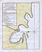
1764 Bellin Map of Acapulco, Mexico - Geographicus - Acapulco-bellin-1764.jpg 2,193 × 2,724; 999 KB
-
1764 Bellin Map of Bombay (Mumbai) India - Geographicus - Bombay-bellin-1750.jpg 2,099 × 2,705; 1.39 MB
-
1764 Bellin Map of Cape Town (Cape of Good Hope) - Geographicus - GoodHope3-bellin-1763.jpg 2,100 × 2,576; 1,012 KB
-
1764 Bellin Map of Macao China.jpg 2,103 × 2,628; 832 KB
-
1778 Bellin Nautical Chart or Map of the World - Geographicus - World-bellin-1778.jpg 4,000 × 2,902; 3.67 MB
-
1852 Bellin Map of Sumatra, Malaca, and Singapore - Geographicus - Sumatra-bellin-1750.jpg 3,000 × 2,566; 1.61 MB
-
Amsterdam-St. Paul views by Bellin 1760.jpg 1,676 × 2,187; 1.48 MB
-
Belanda Melaka.jpg 1,148 × 986; 342 KB
-
Carte de lIsle de la Jamaique (2674145379).jpg 2,000 × 1,428; 2.21 MB
-
Isle de Madagascar autrement isle de St Laurent - par N.B. - btv1b8595714s.jpg 4,623 × 5,495; 3.64 MB
-
Jacques Nicholas Bellin - Print - Estampe - Google Art Project.jpg 3,382 × 4,757; 7.8 MB
-
Jacques-Nicolas Bellin, Carte de l'Archipel (FL13730710 3369712).jpg 10,774 × 14,719; 219.4 MB
-
Jacques-Nicolas Bellin, Carte de l'Empire du Japon (FL37098945 2469447).jpg 9,333 × 6,137; 79.09 MB
-
Jacques-Nicolas Bellin, Carte de l'entrée du canal des Dardanelles (FL33127501 2370304).jpg 5,928 × 6,396; 50.74 MB
-
Jacques-Nicolas Bellin, Carte de l'etat de Raguse (FL37479317 2590098).jpg 5,381 × 7,816; 58.28 MB
-
Jacques-Nicolas Bellin, Carte de la baye de Gibraltar (FL13721129 2470669).jpg 9,733 × 7,325; 94.79 MB
-
Jacques-Nicolas Bellin, Carte de la baye de Gibraltar (FL147556163 2471012).jpg 2,295 × 2,860; 6.35 MB
-
Jacques-Nicolas Bellin, Carte de la Mer Noire (FL36554727 2631528).jpg 4,820 × 4,094; 28.3 MB
-
Jacques-Nicolas Bellin, Carte de La Mer Rouge et partie de L'Arabie (FL35865306 2491233).jpg 9,822 × 7,540; 93.81 MB
-
Jacques-Nicolas Bellin, Carte de la Syrie (FL13729651 2516132).jpg 3,883 × 5,438; 27.39 MB
-
Jacques-Nicolas Bellin, Carte De La Tartarie Occidentale (FL36380694 2622423).jpg 8,372 × 5,753; 65.39 MB
-
Jacques-Nicolas Bellin, Carte des embouchures de l'Euphrate (FL167468672 2473373).jpg 5,659 × 7,900; 43.92 MB
-
Jacques-Nicolas Bellin, Carte des variations de la boussole (FL27971628 2719547).jpg 22,240 × 15,095; 457.82 MB
-
Jacques-Nicolas Bellin, Carte Du Canal De La Mer Noire (FL36554757 2631531).jpg 4,888 × 3,213; 21.33 MB
-
Jacques-Nicolas Bellin, Carte du Golphe Persique (FL33131191 2517559).jpg 9,284 × 7,369; 90.73 MB
-
Jacques-Nicolas Bellin, Carte reduite des costes Occidentales d'Afrique (FL13727099 2497494).jpg 14,601 × 10,504; 227.29 MB
-
Jacques-Nicolas Bellin, Carte Réduite De L'Ocean Oriental ou Mer Des Indes (FL37817104 3153786).jpg 20,930 × 14,237; 413.79 MB
-
Jacques-Nicolas Bellin, Carte réduite de la Mer Méditerranée (FL13732019 3370478).jpg 8,428 × 5,241; 60.08 MB
-
Jacques-Nicolas Bellin, Costes de d'Egypte (FL167448368 2369913).jpg 10,200 × 7,770; 79.36 MB
-
Jacques-Nicolas Bellin, Golpe de Tunis (FL167448359 2369912).jpg 5,722 × 7,739; 42.22 MB
-
Jacques-Nicolas Bellin, Plan d'Oran (FL13730020 2565730).jpg 3,900 × 5,267; 23.71 MB
-
Jacques-Nicolas Bellin, Plan de Gibraltar (FL13722290 2470734).jpg 7,120 × 5,187; 48.8 MB
-
Jacques-Nicolas Bellin, Plan de la Baye d'Alger (FL167448340 2369910).jpg 10,228 × 7,738; 77.77 MB
-
Jacques-Nicolas Bellin, Plan de la Rade de Sour en Syrie (FL167421464 2369899).jpg 5,566 × 7,809; 42.03 MB
-
Jacques-Nicolas Bellin, Plan de la ville de Constantinople (FL33127516 2370305).jpg 11,124 × 7,772; 119.15 MB
-
Jacques-Nicolas Bellin, Plan de la ville de Mellila (FL13730002 2565725).jpg 3,853 × 5,222; 23.03 MB
-
Jacques-Nicolas Bellin, Plan de la Ville de Moka (FL33122114 2369905).jpg 5,256 × 7,623; 50.69 MB
-
Jacques-Nicolas Bellin, Plan de la ville et chateau de Gallipoli (FL33127491 2370303).jpg 5,892 × 7,932; 63.27 MB
-
Jacques-Nicolas Bellin, Plan de Seide en Syrie (FL167421445 2369901).jpg 5,621 × 7,819; 42.21 MB
-
Jacques-Nicolas Bellin, Plan de Tripoli de Syrie (FL167421440 2369898).jpg 5,672 × 7,984; 53.7 MB
-
Jacques-Nicolas Bellin, Plan de Zara (FL167468745 2563779).jpg 5,741 × 7,985; 46.1 MB
-
Jacques-Nicolas Bellin, Plan des Ports et Ville d'Alexandrie (FL163876641 2369900).jpg 5,731 × 7,784; 42.71 MB
-
Jacques-Nicolas Bellin, Rade et ville de Ceute (FL13729995 2565718).jpg 3,856 × 5,216; 23.97 MB
-
Jacques-Nicolas Bellin, Vera delineatio civitatis Bassorae (FL37476699 2473381).jpg 10,350 × 9,031; 133.82 MB
-
Le Neptune Francois .I. Volume.jpg 966 × 1,264; 360 KB
-
Rade et ville de Ceute - Bellin - btv1b85954385.jpg 3,641 × 4,310; 2.29 MB
-
Tableau des pavillons ou bannières que la plupart des nations arborent à la mer (BnF).jpg 10,764 × 7,425; 100.68 MB
-
Tableau des pavillons ou bannières que la plupart des nations arborent à la mer, 1756.jpg 7,242 × 5,018; 48.44 MB


