Category:Bathymetric maps of the Mediterranean Sea
Jump to navigation
Jump to search
Subcategories
This category has only the following subcategory.
Media in category "Bathymetric maps of the Mediterranean Sea"
The following 31 files are in this category, out of 31 total.
-
Adriatic Sea Bathymetry.svg 597 × 562; 348 KB
-
Aegean Sea map bathymetry-fi.svg 3,750 × 4,560; 3.52 MB
-
Aegean Sea map bathymetry-fr.jpg 3,744 × 4,554; 4.22 MB
-
Aegean Sea map bathymetry-fr.svg 3,750 × 4,560; 3.57 MB
-
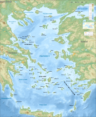
Aegean Sea map bathymetry.svg 3,750 × 4,560; 3.54 MB
-
Aegean Sea map bathymetry ar.svg 4,688 × 5,700; 5.18 MB
-
Aegean Sea map bathymetry-es.png 2,500 × 3,040; 8.49 MB
-
Aegean Sea map bathymetry-es.svg 3,750 × 4,560; 3.42 MB
-
Aegean Sea map bathymetry-tr.svg 3,750 × 4,560; 3.6 MB
-
Aeolian Arc.jpg 925 × 676; 140 KB
-
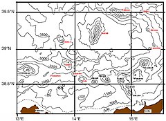
Bathy Eratosthene.jpg 784 × 717; 204 KB
-
Blanes-Palamos Mar balear bm wms 2004.jpg 1,200 × 877; 332 KB
-
Calypso deep.jpg 631 × 538; 66 KB
-
Erastosthenes seamount bathymetry.png 4,027 × 4,174; 3.05 MB
-
Erastosthenes seamount bathymetry3d.png 8,336 × 4,974; 5.58 MB
-
FMIB 43854 Profile of the Bed of the Adriatic.jpeg 710 × 392; 38 KB
-
France relief location map.jpg 2,000 × 1,922; 907 KB
-
GEBCO-OpenSeaMap-Water-depth-Gibraltar.jpg 1,024 × 513; 69 KB
-
Hellenic Trench bathymetric features.png 3,013 × 2,081; 6.15 MB
-
Map Geomorphology I 1992 - Touring Club Italiano CART-TEM-021.jpg 5,000 × 3,312; 11.94 MB
-
Map Geomorphology II 1992 - Touring Club Italiano CART-TEM-022.jpg 5,000 × 3,279; 11.29 MB
-
Map Italy in the Mediterranean sea 1990 - Touring Club Italiano CART-TEM-003.jpg 7,000 × 4,627; 22.11 MB
-
Mar Balear - BM WMS 2004.jpg 1,060 × 989; 210 KB
-
Mar Mediterranèa - Estrech de Sicília.png 2,626 × 1,265; 889 KB
-
Mar Mediterranèa - Fòssas Ellenicas.png 2,626 × 1,265; 899 KB
-
Mar Mediterranèa - Topografia - Localizacion dau Cap Matapan.png 2,626 × 1,265; 882 KB
-
Mar Mediterranèa - Topografia.png 2,626 × 1,265; 892 KB
-
Mediterranean Sea Bathymetry map.svg 4,252 × 2,000; 4.3 MB
-
Mediterranean Sea surface.jpg 1,274 × 628; 237 KB
-
Unterwasser-Quellen Mittelmeer Schwarzes-Meer und Anrainerstaaten.jpg 1,600 × 800; 1.28 MB
-
USGS CMG InfoBank Atlas, Lebanon regions.jpg 623 × 732; 219 KB