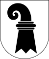
Basel-Stadt
Appearance
Kanton Basel-Stadt | |
|---|---|
 | |
| Coordinates: 47°34′N 7°36′E / 47.567°N 7.600°E | |
| Capital | Basel |
| Subdivisions | 3 municipalities |
| Government | |
| • Executive | Executive Council (7) |
| • Legislative | Grand Council (100) |
| Area | |
| • Total | 36.95 km2 (14.27 sq mi) |
| Population (July 2021)[2] | |
| • Total | 201,156 |
| • Density | 5,400/km2 (14,000/sq mi) |
| ISO 3166 code | CH-BS |
| Highest point | 522.19 m (1,713 ft): St. Chrischona |
| Lowest point | 244.75 m (803 ft): Rhine shore, national border at Kleinhüningen |
| Joined | 1501 |
| Languages | German |
| Website | www |
Basel-Stadt is one of the 26 cantons of Switzerland. The capital is Basel. It is the smallest canton by area.
Municipalities
[change | change source]There are three municipalities:
| Municipality | Population (30 June 2021)[3] |
Area |
|---|---|---|
| Basel | 178,120 | 23.85 |
| Bettingen | 1,248 | 2.23 |
| Riehen | 21,788 | 10.87 |
References
[change | change source]- ↑ Arealstatistik Land Cover - Kantone und Grossregionen nach 6 Hauptbereichen accessed 27 October 2017
- ↑ Canton of Basel-Stadt Statistics, MS Excel document – T01.0.01 - Bevölkerungsstand 31 July 2021 numbers (in German) accessed 21 September 2021
- ↑ Canton of Basel-Land Statistics, Wohnbevölkerung nach Nationalität und Konfession per 30. Juni 2021 (in German) accessed 22 September 2021
Other websites
[change | change source]Wikimedia Commons has media related to Basel-Stadt.
- Official website
- Official statistics
- Basel-Stadt in German, French and Italian in the online Historical Dictionary of Switzerland.

