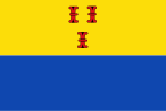
Barneveld
Appearance
Barneveld | |
|---|---|
 Kirk in Barneveld | |
 Location in Gelderland | |
| Coordinates: 52°8′N 5°35′E / 52.133°N 5.583°ECoordinates: 52°8′N 5°35′E / 52.133°N 5.583°E | |
| Kintra | Netherlands |
| Province | Gelderland |
| Govrenment | |
| • Bodi | Municipal cooncil |
| • Mayor | Asje van Dijk (CDA) |
| Area | |
| • Total | 176.69 km2 (68.22 sq mi) |
| • Laund | 175.96 km2 (67.94 sq mi) |
| • Water | 0.73 km2 (0.28 sq mi) |
| Elevation | 10 m (30 ft) |
| Population (Januar 2021)[4] | |
| • Total | 59,992 |
| • Density | 341/km2 (880/sq mi) |
| Demonym(s) | Barnevelder |
| Time zone | UTC+1 (CET) |
| • Summer (DST) | UTC+2 (CEST) |
| Postcode | 3770–3785, 3794, 3886 |
| Aurie code | 0342, 0577 |
| Website | www |
Barneveld (pronunciation (help·info)) is a toun an a municipality in the province o Gelderland in the centre o the Netherlands.
References
[eedit | eedit soorce]- ↑ "College van B&W" (in Dutch). Gemeente Barneveld. Retrieved 19 Juin 2014. Unknown parameter
|trans_title=ignored (help) - ↑ "Kerncijfers wijken en buurten" [Key figures for neighbourhoods]. CBS Statline (in Dutch). CBS. 2 Julie 2013. Retrieved 12 Mairch 2014.
- ↑ "Postcodetool for 3771ER". Actueel Hoogtebestand Nederland (in Dutch). Het Waterschapshuis. Archived frae the original on 21 September 2013. Retrieved 19 Juin 2014. Cite has empty unkent parameter:
|trans_title=(help) - ↑ "Bevolkingsontwikkeling; regio per maand" [Population growth; regions per month]. CBS Statline (in Dutch). CBS. 1 Januar 2021. Retrieved 2 Januar 2022.

