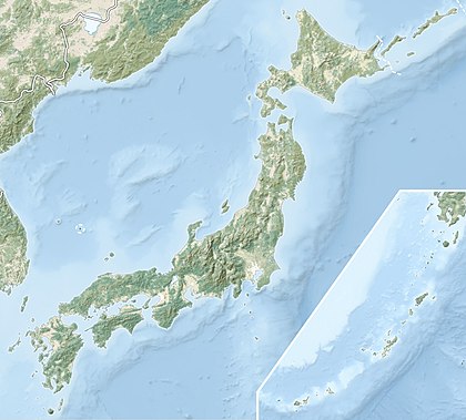
Mount Kita (北岳, Kita-dake) is a mountain of the Akaishi Mountains−"Southern Alps" (南アルプス Minami-Arupusu), in Yamanashi Prefecture, Japan.
| Mount Kita | |
|---|---|
| 北岳 | |
 Mount Kita viewed from Mount Nakashirane | |
| Highest point | |
| Elevation | 3,193 m (10,476 ft)[1] |
| Prominence | 2,239 m (7,346 ft)[2] |
| Listing | 100 Famous Japanese Mountains Ultra |
| Coordinates | 35°40′27″N 138°14′12″E / 35.67417°N 138.23667°E[2] |
| Naming | |
| English translation | northern peak |
| Language of name | Japanese |
| Pronunciation | [ki̥tadake] |
| Geography | |
| Location | Minami-Alps, Yamanashi Prefecture, Japan |
| Parent range | Akaishi Mountains |
| Topo map(s) | Geographical Survey Institute (国土地理院, Kokudochiriin) 25000:1 仙丈ヶ岳, 50000:1 市野瀬 |
| Climbing | |
| Easiest route | Hike |

It is the second tallest mountain in Japan, after Mount Fuji, and is known as "the Leader of the Southern Alps".[3] It is included in the 100 Famous Japanese Mountains. It is located in Minami Alps National Park, near the city of Minami-Alps, Yamanashi Prefecture.
Geography
editThe Kitadake Buttress (北岳バットレス, Kita-dake Battoresu) is a 600 m (1,969 ft) tall rock face on the eastern side of the mountain.
Alpine plants grow abundantly, especially on the mountain's southeastern slope along the route to Mount Nakashirane (中白峰山, Nakashirane-san) and along the Kusasuberi (草すべり, kusasuberi) and Migimata (右俣, migimata) courses along Shiraneo Pond (白根御池, Shiraneo-ike) on the mountain's northern side. Large clusters of plants can be seen from huts near the top. The species Callianthemum hondoense (キタダケソウ, kitadakesō) is endemic to this mountain.
See also
editReferences
edit- ^ Geographical Survey Institute map 25000:1 仙丈ヶ岳 accessed online 8 April 2008.
- ^ a b "Japan Ultra-Prominences". Peaklist.org. Retrieved 2015-01-01.
- ^ Mount Kita Archived 2011-07-22 at the Wayback Machine. (in Japanese) Minami Alps Net. Accessed July 1, 2008.
External links
edit- Topographic map (1:25,000)
