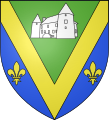
Voussac
Voussac | |
|---|---|
 Church Saint-Martin | |
| Coordinates: 46°19′43″N 3°03′47″E / 46.3286°N 3.0631°E | |
| Country | France |
| Region | Auvergne-Rhône-Alpes |
| Department | Allier |
| Arrondissement | Montluçon |
| Canton | Gannat |
| Intercommunality | Commentry Montmarault Néris Communauté |
| Government | |
| • Mayor (2020–2026) | Isabelle Bidet[1] |
Area 1 | 34.46 km2 (13.31 sq mi) |
| Population (2021)[2] | 491 |
| • Density | 14/km2 (37/sq mi) |
| Time zone | UTC+01:00 (CET) |
| • Summer (DST) | UTC+02:00 (CEST) |
| INSEE/Postal code | 03319 /03140 |
| Elevation | 359–467 m (1,178–1,532 ft) (avg. 463 m or 1,519 ft) |
| 1 French Land Register data, which excludes lakes, ponds, glaciers > 1 km2 (0.386 sq mi or 247 acres) and river estuaries. | |
Voussac (French pronunciation: [vusak]; Occitan: Vosac) is a commune in the Allier department in Auvergne-Rhône-Alpes in central France.[3]
History
[edit]During Antiquity, the territory of Vosiacum was part of the territory of the Gallic people of the Bituriges Cubi.
In the Middle Ages, the commune was part of medieval Berry before passing into the modern-day province of Bourbonnais. The parish was part of the diocese of Bourges until the 1820s.
Geography
[edit]Voussac is located on departmental road 46, the old Route national 146, which connects Montmarault to Saint-Pourçain-sur-Sioule. The commune is bordered by Deux-Chaises to the north, Le Theil to the northeast, Fleuriel to the southeast, Target to the south, and Saint-Marcel-en-Murat to the west.
The Vacheresse Forest occupies a notable portion of the commune's territory, to the south-east of the town.
The Venant, a tributary of the Bouble, crosses the commune, flowing from north to southwest. To the south, its wooded valley separates Voussac from Saint-Marcel-en-Murat.
Climate
[edit]For the period 1971-2000, the average annual temperature was 10.3 °C, with an annual thermal range of 15.9 °C. The average annual cumulative precipitation was 803 mm, with 10.7 days of precipitation in January and 7.3 days in July. For the period 1991-2020, the average annual temperature observed at the nearest Météo-France meteorological station, in the town of Montmarault, 8 km as the crow flies, was 11.2 °C and the average annual cumulative of precipitation was 811.6 mm.
Population
[edit]| Year | Pop. | ±% p.a. |
|---|---|---|
| 1968 | 680 | — |
| 1975 | 514 | −3.92% |
| 1982 | 458 | −1.63% |
| 1990 | 400 | −1.68% |
| 1999 | 458 | +1.52% |
| 2009 | 465 | +0.15% |
| 2014 | 468 | +0.13% |
| 2020 | 489 | +0.73% |
| Source: INSEE[4] | ||
See also
[edit]References
[edit]- ^ "Répertoire national des élus: les maires" (in French). data.gouv.fr, Plateforme ouverte des données publiques françaises. 13 September 2022.
- ^ "Populations légales 2021" (in French). The National Institute of Statistics and Economic Studies. 28 December 2023.
- ^ INSEE commune file
- ^ Population en historique depuis 1968, INSEE


