Cambronne station
| Paris Métro station | |||||||||||
 MP 73 at Cambronne | |||||||||||
| General information | |||||||||||
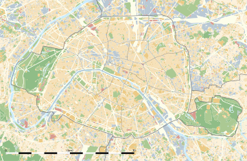
| Location | 15th arrondissement of Paris Île-de-France France | ||||||||||
| Coordinates | 48°50′51″N 2°18′11″E / 48.847537°N 2.302937°E | ||||||||||
| Owned by | RATP | ||||||||||
| Operated by | RATP | ||||||||||
| Line(s) | |||||||||||
| Platforms | 2 (side platforms) | ||||||||||
| Tracks | 2 | ||||||||||
| Other information | |||||||||||
| Station code | 0202 | ||||||||||
| Fare zone | 1 | ||||||||||
| History | |||||||||||
| Opened | 24 April 1906 | ||||||||||
| Passengers | |||||||||||
| 1,636,566 (2021) | |||||||||||
| Services | |||||||||||
| |||||||||||
| |||||||||||
Cambronne (French pronunciation: [kɑ̃bʁɔn]) is an elevated station on Line 6 of the Paris Métro. Located in the 15th arrondissement, it is named after the nearby Place Cambronne and Rue Cambronne, which were in turn named after Viscount Pierre Cambronne (1770–1842), a general at the Battle of Waterloo. The station is at the location of the former Barrière de l'École-Militaire, a gate built for the collection of taxes as part of the Wall of the Farmers-General; the gate was built between 1784 and 1788 before it was demolished prior to 1859 amid Haussmann's renovation of Paris.[1][2]
History
[edit]The station opened as part of the former Line 2 South on 24 April 1906 when it was extended from Passy to Place d'Italie. On 14 October 1907, Line 2 South was incorporated into Line 5. It was then temporarily absorbed by Line 6 from 17 May to 6 December 1931. It was permanently absorbed by Line 6 on 6 October 1942.
During the summer of 2014, the canopies above the tracks were renovated and as part of the "Renouveau du métro" programme by the RATP, the station was renovated on 30 June 2015.[3]
In 2019, the station was used by 2,524,418 passengers, making it the 207th busiest of the Métro network out of 302 stations.[4]
In 2020, the station was used by 1,567,953 passengers amidst the COVID-19 pandemic, making it the 167th busiest of the Métro network out of 304 stations.[5]
In 2021, the station was used by 1,636,566 passengers, making it the 218th busiest of the Métro network out of 304 stations.[6]
Passenger services
[edit]Access
[edit]The station has 2 access on either side of Boulevard Garibaldi:
- Access 1: Boulevard Garibaldi Côté des numéros impairs (odd numbered)
- Access 2: Boulevard Garibaldi Côté des numéros pairs (even numbered)
Station layout
[edit]| Platform level | Side platform, doors will open on the right | |
| toward Charles de Gaulle – Étoile | ← | |
| toward Nation | | |
| Side platform, doors will open on the right | ||
| 1F | Mezzanine | |
| Street Level | ||
Platforms
[edit]The station is elevated and has a standard configuration with two tracks surrounded by two side platforms.
Other connections
[edit]The station is also served by line 80 of the RATP bus network, as well as at night, by lines N12 and N61 of the Noctilien network.
Gallery
[edit]-
Station exterior
-
Stairs leading to the platforms
-
Station platforms
References
[edit]- ^ "Barrière de l'École-Militaire, picture" (in French). Bibliothèque nationale de France. Retrieved 20 December 2009.
- ^ "Barrière de l'École-Militaire" (in French). Bibliothèque nationale de France. Retrieved 20 December 2009.
- ^ "Le Renouveau du Métro". www.symbioz.net (in French). Retrieved 23 December 2022.
- ^ "Trafic annuel entrant par station du réseau ferré 2019". dataratp2.opendatasoft.com (in French). Archived from the original on 21 January 2022. Retrieved 23 December 2022.
- ^ "Trafic annuel entrant par station du réseau ferré 2020". data.ratp.fr (in French). Archived from the original on 21 January 2022. Retrieved 23 December 2022.
- ^ "Trafic annuel entrant par station du réseau ferré 2021". data.ratp.fr (in French). Retrieved 23 December 2022.


