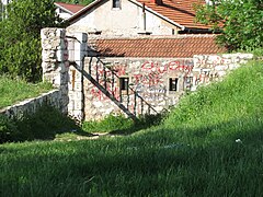
Žuta Tabija
Appearance
| Yellow Fortress | |
|---|---|
Žuta Tabija, Жута Табија | |
| Part of Walled City of Vratnik | |
| Jekovac, Sarajevo, Bosnia and Herzegovina | |
 Žuta Tabija | |
 | |
| Coordinates | 43°51′41″N 18°26′16″E / 43.861480°N 18.437741°E |
| Type | Cannon fort |
| Site history | |
| Built | 1727–1739 |
| Built by | Ahmed-paša Rustempašić Skopljak |
| Materials | Sandstone |
The Yellow Fortress or Yellow Bastion (Bosnian, Croatian and Serbian: Žuta Tabija, Serbian Cyrillic: Жута Табија) is a cannon fortress at the entrance of the "Walled City of Vratnik". It was built between 1727 and 1739 in area called Jekovac, close to the Jajce Barracks and the Jekovac water reservoir. It served as one of the defense points against the Austro-Hungarian troops in 1878. The fortress was damaged and rebuilt several times. The most recent renovation took place in 1998.[1][2][3][4]
-
Žuta tabija
-
View of Sarajevo from Zuta tabija
-
Yellow Fortress Walls
-
Entrance into Žuta tabija (2010)
-
Windows of Žuta tabija
See also
[edit]References
[edit]- ^ "Žuta tabija | Furaj.ba". www.furaj.ba. Archived from the original on 2014-07-08.
- ^ sarajevo-tourism.com (16 September 2015). "Vratnik town walls with tower-gates".
- ^ kulturno-nasljedje.com (16 September 2015). "Old town Vratnik (history with maps)".
- ^ Commission to preserve national monuments (16 September 2015). "Old Vratnik Fort, the architectural ensemble". kons.gov.ba. Retrieved 16 September 2015.
Wikimedia Commons has media related to Žuta Tabija.


