User:Dkallen78/Jilotepec
History
[edit]Etymology
[edit]The name Jilotepec derives from the náhuatl words jilote (tender or unripe corn) and tepetl (hill), literally "hill of tender corn." The name of one of the Aztec corn goddesses is Xilonen, so some scholars say Jilotepec signifies "hill of the corn goddess. In otomí the region was known as Ma-Denxi.[1]
Prehispanic
[edit]The first group known to have settled in the Jilotepec region were the Otomí people who came from the coast of the Gulf of Mexico. They lived there independently until 1379 when the Aztec tlatoani Acamapichtli conquered the region, bringing it into the Aztec empire. For the next hundred years the history is unclear but it is recorded that they were defeated again during the reign of Axayácatl, the sixth tlatoani of the Aztecs and once more during the reign of Ahuítzotl in 1487 to supply sacrifices for his coronation.[1][2][3]
Colonial
[edit]Being part of the Aztec empire, when Tenochtitlán fell to Hernán Cortés and the Spanish in 1523, it became part of the new colonial empire. Some of the first Europeans to enter the Jilotepec region were the Franciscan monks Friars Alonso de Rangel and Antonio de Ciudad Rodrigo. Alonso de Rangel was one of the first Europeans to learn the otomí language which he used to preach to and convert the local population.[1]
The first encomendero of Jilotepec was the lieutenant of Hernán Cortés, Juan Jaramillo, husband of La Malinche. The encomienda of Jilotepec was one of the best in the new colony and was contested amongst the descendants of Juan Jaramillo until 1604 when the Spanish crown retook possession of it and redistributed it.[1]
Jilotepec was on the frontier of the colony in the 16th century. It was used as a launching point for the conquest of the Bajío region against the Chichameca tribes. Notable native caciques of this period include Nicolás de San Luis Montañez, Juan Bautista Valerio de la Cruz, and Hernando de Tapia, who commanded Otomí armies against the Chichameca tribes in the early days of the conquest of the Bajío.[1]
Geography
[edit]Jilotepec lies in the north of the state of Mexico. To its north is the state of Hidalgo, to the south are the municipalities of Chapa de Mota and Timilpan, to the southeast is Villa del Carbón, to the east is Soyanilquilpan, and to the west are Polotitlán and Aculco.
Political Geography
[edit]There is one city in the municipality of Jilotepec, the municipal head Jilotepec de Molina Enríquez which is divided into six neighborhoods, or colonias: Colonia Centro, Javier Barrios, La Merced, El Deni, La Cruz de Dendho, and Xhisda.
There is only one village, or villa, the Villa de Canalejas
There are 23 towns, or pueblos:[4][5]
| Name | Population (2010) |
|---|---|
| Acazuchitlán | 3,037 |
| Agua Escondida | 2,467 |
| Aldama | 2,005 |
| Buenavista | 2,151 |
| Calpulalpan | 3,800 |
| Coscomate del Progreso | 1,547 |
| Dexcaní Alto | 1,101 |
| Dexcaní Bajo | 1,426 |
| Doxhichó | 1,992 |
| El Rosal | 1,234 |
| Ejido San Lorenzo Octeyuco | 2,659 |
| Las Huertas | 3,931 |
| San Lorenzo Nenamicoyan | 2,008 |
| San Lorenzo Octeyuco | 685 |
| San Martín Tuchicuitlapilco | 1,942 |
| San Miguel de la Victoria | 3,238 |
| San Pablo Huantepec | 3,996 |
| Santiago Oxthoc | 1,124 |
| Xhimohay | 2,503 |
| Xhixhata | 2,195 |
| El Saltillo | 765 |
| Las Manzanas | 2,803 |
| La Comunidad | 2,589 |
There are 24 small towns, or rancherías:[4][5]
| Name | Population (2010) |
|---|---|
| Emiliano Zapata | 154 |
| Danxho | 1,096 |
| Dedeni Dolores | 291 |
| Denjhi | 1,238 |
| El Durazno de Cuauhtémoc | 1,014 |
| El Durazno de Guerrero | 119 |
| El Magueyal | 1,236 |
| El Majuay | 136 |
| El Rincón | 691 |
| El Xhitey | 1,189 |
| Ejido de Coscomate | 1,452 |
| Ejido de Jilotepec | 801 |
| La Huaracha | no data |
| La Maqueda | 452 |
| Llano Grande | 311 |
| Magueycitos | 548 |
| Mataxhi | 253 |
| Mexicaltongo | no data |
| Octeyuco 2000 | 1,158 |
| Ojo de Agua | 1,221 |
| San Ignacio de Loyola | 118 |
| Santa Martha de la Cruz | 250 |
| Tecolapan | 928 |
| Teupan | 895 |
Physical Geography
[edit]The primary geographical features of the region are fertile plains interrupted by hills and canyons. The municipality sits at the northern edge of the Trans-Mexican Volcanic Belt physiographic region on the Sierra Nevada mountain range. The municipality is further divided by the subregions of the plains and mountains of Querétaro and Hidalgo to the north, and the lakes and volcanoes of Anáhuac comprising a small part of the municipality to the south.[2][4][6] It is the fifth largest municipality in the state of Mexico.[7]
Geology
[edit]The geological substrate of the municipality is primarily extrusive igneous rock, that is, volcanic in origin. These rocks are notable for the presence of basaltic lava flows, deposits of basaltic ash, slag, and pyroclastic rocks. Many of the older buildings in Jilotepec were build using these basaltic rocks.[5]
The soil is mostly luvisolic, comprises 75% of the municipality's soil, and is particularly suited to agricultural industry though susceptible to erosion. About 15% of the soil is vertisolic and is located in the east of the municipality. This soil is prone to contraction in the dry season and is suited for grasses and grazing.[4]
The primary mineral resource of the region is kaolin, a white clay that is useful in porcelain and medicine making. Other minerals that can be found in the municipality include chalcedony and tezontle.[4]
Hydrology
[edit]Jilotepec is in the Alto Pánuco hydrologic region of the state of Mexico in the San Juan river basin. The most notable river in the municipality is the Coscomate which feeds into the Danxho resevoir and numerous streams such as Los Charcos, El Colorado, Dedeni, La Mina and 40 others. The Huapango resevoir is the municpality's largest at 120 million m3, followed by the Danxho with 31 million m3, and the Santa Elena with 5 million m3. In addition to other smaller streams and resevoirs the municipality is supplied with water by the San Pablo Huantepec spring which flows at 10 L/s.[4][5]
The municipality has a good supply of underground water thanks to the high permeability of the soil in most of the region. The quality of the water is "acceptable" though it is contaminated with waste and untreated water, especially in the municipal head where the Coscomate River and Colorado Stream flow.[5]
Fauna
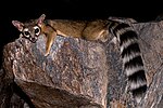
[edit]Jilotepec has not done an exhaustive survey of the wildlife within its municipal borders but they do have an informal registry of species. There is a diversity of frogs, lizards, and snakes (only three of which are venomous) in Jilotepec. The birds of the region concentrate around the forests and lakes and represent the greatest diversity of wildlife in the municipality. The mammals of the region include common herbivores and carnivores such as weasels, coyotes, squirrels, and possums.[4]
Fish
[edit]Only the charal is common to the region. It is commonly fished for food and typically dried. The charal has a wide tolerance for changes in weather common to the municipality throughout the year. Though it is easily found and commonly consumed, there is no industry actively exploiting the charal population in Jilotepec. Though not native to the region, carp (Cyprinus carpio) and largemouth bass (Micropterus salmoides) are commercially farmed, recently being introduced to the Huapango resevoir.[4]
Flora
[edit]Jilotepec's vegetation is predominantly semiarid grassland. In the north, the oak forests of Las Peñas are the largest in the state of Mexico.[8] Throughout the municipality maguey, nopal, and tejocote are common, as well as many plants used in traditional medicinal recipes. There are two protected areas in Jilotepec: the state park El Llano Canalejas and the municipal park Las Sequoias as well as many smaller local parks and forests.[4]
Climate
[edit]The climate of Jilotepec varies between Cwa and Cwb on the Köppen climate classification, meaning it's in a temperate zone with dry winters and warm to hot summers. The southern portion of the region is noticeably cooler than the northern region which is closer to the warmer region of the Bajío. Likewise, rain is more intense in the south of the state than in the north.
| Jan. | Feb. | March | April | May | June | July | Aug. | Sept. | Oct. | Nov. | Dec. | |
|---|---|---|---|---|---|---|---|---|---|---|---|---|
| Avg. Temp. (°C) | 11.6 | 13.1 | 15.4 | 16.9 | 17.7 | 17.1 | 16.3 | 16.4 | 15.7 | 14.3 | 13.0 | 12.1 |
| Avg. High Temp. (°C) | 20.0 | 21.0 | 23.5 | 24.3 | 24.5 | 22.6 | 22.0 | 21.7 | 21.0 | 21.0 | 20.3 | 20.0 |
| Avg. Low Temp. (°C) | 3.2 | 4.3 | 6.5 | 8.0 | 10.0 | 11.0 | 11.0 | 11.0 | 10.6 | 8.5 | 5.0 | 3.5 |
| Chance of Rain (%) | 5.8 | 4.7 | 4.5 | 11.8 | 25.5 | 56.3 | 67.8 | 65.3 | 56.0 | 28.0 | 8.7 | 2.7 |
| Avg. Rainfall (mm) | 6.2 | 7.0 | 7.0 | 12.3 | 34.0 | 84. 0 | 104.7 | 96.3 | 87.3 | 41.3 | 11.3 | 3.7 |
Demographics
[edit]In 2010 there were 19,910 dwelling places in Jilotepec. Almost 13% of them didn't have access to a water utility. Nearly 27% didn't have access to a sewer system. 94% of homes had access to electricity. Nearly 32% of houses didn't have a refrigerator, over 57% didn't have a washing machine. Nearly 56% of the population did not have a car. 91% of municipal residents had a television but only 16% had a computer and just over 6% had access to the internet.[10]
Population
| Year | Population | Men | Women |
|---|---|---|---|
| 2000 | 68,336 | 33,832 | 34,504 |
| 2010 | 83,755 | 41,088 | 42,667 |
| 2015 | 87,927 | 42,745 | 45,182 |
| 2016 | 89,100 | 43,208 | 45,892 |
| 2017 | 90,016 | 43,568 | 46,448 |
| 2018 | 100,808 | 49,552 | 41,256 |
Immigration
There is no significant migration to Jilotepec. In 2010, Over 99% of residents had been born in Mexico and 85% of the population had been born in the state of Mexico.
Age
In 2015, 29% of the population was under age 15, 27% were between the ages of 15 and 29, 21% were between the ages of 30 and 44, 13% were between the ages of 45 and 59, and 9% were older than 60. Women comprised 51% of the population.
Language
As of 2015, 99% of the population of Jilotepec speaks Spanish. Only 0.3% (321) of the population speaks an indigenous language.The most commonly spoken indigenous language is Otomí (162) followed by Náhuatl (45) and Mazahua (20).
Crime
Crime in Jilotepec has dropped noticeably over the 10 years between 2007 and 2017. Homicides have dropped from a high of 46 in 2012 to only 3 in 2017. There has been a similar decline in robberies from a high of 391 reported in 2010 to 134 in 2017. This is likely due to an expansion of economic opportunities brought about by the construction of large industrial plants and industrial parks.[5]
Economy
[edit]The nature of the economy of Jilotepec has shifted over the last ten years. Agriculture and livestock have been the traditional sectors of the economy, but services and industry have made rapid gains. While the gross domestic product of agriculture has ebbed and flowed in the period from 2007 to 2017, the GDP of services and industries has swollen from MXN$427.83 million to MXN$725.08 million and MXN$569.5 million to MXN$1.469 billion.[5]
Municipal Gross Domestic Product per Year:
| Year | GDP (million MXN$) |
|---|---|
| 2007 | 1,428.09 |
| 2008 | 1,574.46 |
| 2009 | 1,588.62 |
| 2010 | 1,834.98 |
| 2011 | 2,067.91 |
| 2012 | 2,356.6 |
| 2013 | 2,454.82 |
| 2014 | 2,219.78 |
| 215 | 2,399.36 |
| 2016 | 2,471.72 |
| 2017 | 2,613.5 |
Agriculture
[edit]One of the largest industries of Jilotepec is agriculture. In 2012, 15,572 ha was dedicated to cultivation with the vast majority (13,000 ha) dedicated to corn grain with an annual production of 63,000 tons. Oats were the second most important crop with 1,770 ha dedicated to its cultivation and 38,367 tons produced. Other important crops include barley, beans, and wheat. The principal perennial crops of the municipality are apples and peaches with an annual production of 33 tons and 133 tons respectively.[10]
Livestock
[edit]Jilotepec is the leader of poultry production in the state of Mexico with 11,893 tons produced in 2018. It produced 1,181 tons of beef, .925 tons of goat, 67.83 tons of turkey, 160.348 tons of sheep, and 763.748 tons of pork. It produced .323 tons of beeswax, 14.9 tons of honey, 582.845 tons of eggs, 24.613 tons of wool and 24.613 tons of cow milk.[11]
Industry
[edit]Jilotepec is perfectly situated between the metropolises of Mexico City and Querétaro to facilitate the production and delivery of goods. It is also on the border with the state of Hidalgo and therefore close to the large markets in Pachuca, Tulancingo, and Tula. Furthermore, two major highways intersect in Jilotepec: the Pan-american Highway and the Arco Norte which links the state of Mexico with Hidalgo, Tlaxcala, and Puebla. One of the first companies to take advantage of this was Truper which has built one of the largest industrial projects in the country there. This incentivized the construction of other projects in the municipality, most notably an industrial park in 2010 with an initial investment of MXN$13.5 billion pesos.[7]
Other major businesses located in Jilotepec include ADS Mexicana, FLEXICO, Concreto Polimérico Castor, PROT A+M, Servicios Químicos y Maquilas, KALTEX, and recently distribution centers for General Motors and Liverpool. Despite these large capital investments, Jilotepec has failed to reach any agreements with these businesses, especially regarding their need for qualified workers. Nor have the municipalities two universities (El Tecnológico de Estudios Superiores and the Universidad Mexiquense del Bicentenario) developed academic programs to prepare locals for employment with these companies.[7]
Markets
[edit]There are three covered markets in Jilotepec, two in the municipal capital (San José and Divina Providencia) each with 21 stalls, and a smaller one in Acazuchitlán. The municipality also has 13 tianguis, weekly open-air street markets. The largest of them occurs every Friday in Jilotepec de Molina Enríquez and can have over 1,600 vendors divided into three shopping districts: fruits, vegetables, and food; clothing and other items; and livestock. People come from as far as the neighboring state of Hidalgo to shop the Jilotepec tianguis.[5]
Arts and Culture
[edit]
Sports
[edit]
Parks and Recreation
[edit]Las Peñas is the principal tourist attraction of Jilotepec. Located in the community of Dexcani Alto, its stone monoliths are ideal for climbing and mountain biking. Las Peñas also has the largest reserve of oak forest in the state of Mexico. There are dozens of climbing routes as well as cabins that one can rent. The best times to climb are between October and March when the seasonal rains have passed. Other activities of interest are horse riding and bird watching.[12]
Sanctuary of Canalejas
Government
[edit]In 2012, the municipality took in over MXN$18.5 million in revenue, over MXN$2 million of which came from taxes. MXN$24.3 million was spent by the municipality in the same year with MXN$14.9 million being listed as personal services (servicios personales) and only MXN$72,900 being marked for public investment and MXN$1.5 million being spent to service the public debt.[10] As of 2015, Jilotepec has the lowest public investment per capita of all of its municipal neighbors at MXN$552.54.[11]
| Municipal President | Time in Office | Political Party |
|---|---|---|
| Martín Cadena | 1934-1935 | |
| Cirilo Franco Núñez | 1936-1937 | |
| Pastor F. Maldonado | 1938-1939 | |
| Luis Sánchez | 1940-1941 | PRM |
| Juan Soto Monroy | 1942-1943 | PRM |
| Francisco Buitrón M. | 1944-1945 | PRM |
| Pedro B. Noguez | 1946-1948 | PRI |
| Salvador Flores Parra | 1949-1951 | PRI |
| Juan Soto Monroy | 1952-1954 | PRI |
| Facundo Arciniega | 1955-1957 | PRI |
| Marcelino Sánchez B. | 1958-1960 | PRI |
| Daniel Maldonado R. | 1961-1963 | PRI |
| Dr. Jacob del Río | 1964-1965 | PRI |
| Mariano Franco Miranda | 1965-1966 | PRI |
| Dr. Heriberto Ortega | 1967-1969 | PRI |
| Daniel Maldonado R. | 1970-1972 | PRI |
| Mario Franco Miranda | 1973-1975 | PRI |
| Romualdo García Cruz | 1976-1978 | PRI |
| Lic. Josafat Sánchez | 1979-1981 | PRI |
| Rodolfo Noguez Soto | 1982-1984 | PRI |
| Prof. Javier Barrios G. | 1985-1987 | PRI |
| Lic. Regina Reyes Retana | 1988-1990 | PRI |
| Lic. Ricardo Garcia Maldonado | 1994-1996 | PRI |
| Heriberto Ortega Ramírez | 1997-2000 | PRI |
| Ricardo Aguilar Castillo | 2000=2003 | PRI |
| Marlon Martínez Martínez | 2003-2006 | APT |
| Felipe Vega Becerril | 2006-2009 | PRD |
| Jesús Sanchez García | 2009-2012 | C.C. |
| Edgar Castillo Martínez | 2013-2015 | CPEM |
| Felipe Vega Becerril | 2016-2018 | PNA |
| Agustin Bonilla Rodriguez | 2019-2021 | MORENA |
Education
[edit]As of 2010, only 7% of the population above the age of 15 was illiterate. There were 293 schools open during the 2011-2012 school year employing 1,668 teachers with 29,588 students enrolled. In 2012 there were eight public libraries.
Media
[edit]
Infrastructure
[edit]The municipality of Jilotepec had 240 km of paved roads in 2018. The municipal capital houses the region's only bus station with 9 bus companies and 155 buses in service as of 2018, and is home to 7 taxi companies with over 100 cars and vans.[5]
Notable People
[edit]
- ^ a b c d e Huitrón Huitrón, Antonio (1985). Monografía Municipal: Jilotepec (PDF) (in Spanish). Mexico. ISBN 968-841-083-7.
{{cite book}}: CS1 maint: location missing publisher (link) - ^ a b "Estado de México - Jilotepec de Abasolo". www.inafed.gob.mx. Retrieved 2019-05-29.
- ^ Chavero, Alfredo (1880). México a Través de los Siglos (PDF) (in Spanish). Vol. 1. México: Ballesca y Compania.
- ^ a b c d e f g h i j k l m Plan de desarrollo Municipal 2016-2018 Jilotepec, México [Municipal Plan of Development 2016-2018 Jilotepec, México] (PDF) (in Spanish). Jilotepec, Estado de México: Ayuntamiento Constitucional de Jilotepec. 2016.
- ^ a b c d e f g h i Plan de Desarrollo Municipal 2019-2021 (PDF) (in Spanish). Jilotepec, Estado de México: Ayuntamiento Constitucional de Jilotepec. 2019.
- ^ Geografía (INEGI), Instituto Nacional de Estadística y. "Mapas. Fisiográficos". en.www.inegi.org.mx (in Spanish). Retrieved 2019-05-30.
- ^ a b c Figueroa Noguez, Areli Alejandra (2018). "Iniciativas de Desarrollo Económico Local en el Municipio de Jilotepec, Estado de México" [Local Economic Development Initiatives in the Municipality of Jilotepec, State of Mexico] (PDF). Agenda Pública para el Desarrollo Regional, la Metropolización y la Sostenibilidad [Public Agenda for Regional Development, Metropolitanization, and Sustainability] (PDF) (in Spanish). Vol. 3. México: Universidad Nacional Autónoma de México. pp. 427–438.
- ^ "Las Peñas – Ayuntamiento Constitucional de Jilotepec 2019-2021" (in Mexican Spanish). Retrieved 2019-05-31.
- ^ "Average Weather in Jilotepec de Molina Enríquez, Mexico, Year Round - Weather Spark". weatherspark.com. Retrieved 2019-05-30.
- ^ a b c Estadística Básica Municipal, Jilotepec [Basic Municipal Statistics, Jilotepec] (PDF) (in Spanish). Mexico: Gobierno del Estado de México. 2013.
- ^ a b "Visor Atlas Cibernético del Estado de México". acvisor.edomex.gob.mx. Retrieved 2019-05-31.
- ^ "Las Peñas – Ayuntamiento Constitucional de Jilotepec 2019-2021" (in Mexican Spanish). Retrieved 2019-05-31.
- ^ "SNIM". www.snim.rami.gob.mx. Retrieved 2019-05-30.


