Royal Wharf
This article has multiple issues. Please help improve it or discuss these issues on the talk page. (Learn how and when to remove these messages)
|
| Royal Wharf | |
|---|---|
| General information | |
| Status | Under construction |
| Location | Newham, London |
| Town or city | London |
| Country | England |
| Coordinates | 51°30′02″N 0°01′46″E / 51.500667°N 0.029427051°E |
| Construction started | July 2014 |
| Estimated completion | 2020 |
| Client | Ballymore Group and Oxley Holdings Ltd |
| Grounds | 161,874 sq m |
| Other information | |
| Number of units | 3,385 |
| Website | |
| royalwharf | |
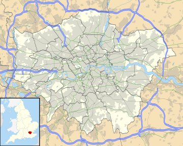
Royal Wharf is a residential and commercial development in Newham, London located on the north bank of the River Thames. It is built on the former site of Minoco Wharf and is near the Thames Barrier, west of Thames Barrier Park, and close to both West Silvertown and Pontoon Dock DLR stations.
The development is a joint venture between Ballymore Group and Singapore listed Oxley Holdings. It includes 3,385 residential units and 10,000 square metres of retail and commercial space.[1]
History
[edit]The 15.2-hectare (38-acre) site was originally developed as an industrial works at the end of the nineteenth century and was also used for the manufacture of TNT during the First World War. Following this, the site was used by Shell UK for a period as an oil storage and refining site. This came to an end in the 1990s, when the site was left vacant.

Silvertown explosion
[edit]Royal Wharf sits on the site of the Silvertown explosion, a large explosion at a munitions factory on 19 January 1917 which killed 73 people and injured more than 400, and caused substantial damage to the local area. As part of the development, the Silvertown War Memorial was relocated to Royal Wharf Gardens, in the centre of the development.
Development
[edit]In 2012, following a comprehensive consultation process with Newham Council officers, the Thames Gateway Development Corporation and local community stakeholders (including local groups and individual residents), planning permission was granted to redevelop the site with a mixed-use scheme, delivering 3,385 new homes, a new primary school, leisure facilities and retail and commercial office space.
As of 2021[update], the development is nearly completed, with two blocks remaining. The Uber Boat by Thames Clippers riverboat pier and Royal Wharf Primary School opened in 2020.[2] The estimated number of occupants once the development is fully complete is around 10,000.
Ballymore is also developing the adjacent riverfront site to the west, Riverscape, to provide 769 homes.[3]
Transport
[edit]
West Silvertown and Pontoon Dock are the nearest stations on the Docklands Light Railway. London bus route 241 serves the housing development.
The site is served by Uber Boat by Thames Clippers catamaran services from a new pier designed by Nex Architects.[4][5] The service started on 18 October 2019[2] and of February 2020 is only served during peak hours.[6]
References
[edit]- ^ Royal Wharf London
- ^ a b "Royal Wharf Pier Officially Open! - Uber Boat by Thames Clippers". Thames Clippers. Retrieved 12 April 2021.
- ^ Brookes, Andrew (24 September 2021). "First apartments to go on sale at 769-home development in Royal Docks". Newham Recorder. Retrieved 19 October 2021.
- ^ Thames Clippers https://www.thamesclippers.com/about-mbna-thames-clippers/news/a-floating-space-for-london-work-begins-on-royal-wharf-pier
- ^ "Royal Wharf Pier". Nex Architecture. Retrieved 12 December 2019.
- ^ "Royal Wharf - The Least Used River Pier". YouTube.
External links
[edit]Lines
[edit]| Preceding station | Following station | |||
|---|---|---|---|---|
| North Greenwich Pier towards Battersea Power Station Pier
|
RB1 | Woolwich (Royal Arsenal) Pier towards Barking Riverside Pier
| ||
| North Greenwich Pier towards Putney Pier
|
RB6 | Terminus | ||
