Sterling, Ohio
Appearance
Sterling, Ohio | |
|---|---|
 Location of Sterling, Ohio | |
| Coordinates: 40°57′58″N 81°50′38″W / 40.96611°N 81.84389°W | |
| Country | United States |
| State | Ohio |
| County | Wayne |
| Township | Milton |
| Elevation | 968 ft (295 m) |
| Population | |
• Total | 432 |
| Time zone | UTC-5 (Eastern (EST)) |
| • Summer (DST) | UTC-4 (EDT) |
| ZIP code | 44276 |
| GNIS feature ID | 2628971[1] |
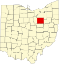
Sterling is an unincorporated, census-designated place in northwestern Milton Township, Wayne County, Ohio, United States[1] with the ZIP code of 44276.[3] The population was 432 at the 2020 census.
History
[edit]Sterling was platted in 1880.[4]
References
[edit]- ^ a b c U.S. Geological Survey Geographic Names Information System: Sterling, Ohio
- ^ "Sterling CPD, Ohio - Census Bureau Profile". United States Census Bureau. Retrieved September 11, 2023.
- ^ Zip Code Lookup
- ^ History of Wayne County, Ohio. B.F. Bowen. 1910. p. 404.
