Mixtla
Appearance
Mixtla (municipality) | |
|---|---|
Municipality and town | |
 | |
| Country | |
| State | Puebla |
| Time zone | UTC-6 (Central Standard Time) |
| • Summer (DST) | UTC-5 (Central Daylight Time) |
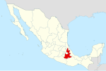
Mixtla (municipality) is a town and municipality in the Mexican state of Puebla in south-eastern Mexico.[1]
As of April 2, 2021, Mixtla had presented two confirmed cases but no deaths related to the COVID-19 pandemic in Mexico.[2]
The dismembered body of former municipal president Altamirano Gonzalo Elías Zopiyactle (2005-2007), 48, was found with a narco-message from "Miauuu" on April 2, 2021 in Zongolica along Mexican Federal Highway 123.found last Friday in Zongolica belongs to the former mayor of Mixtla, both territories of Veracruz.[3]
References
[edit]- ^ "-". Enciclopedia de los Municipios de México. Instituto Nacional para el Federalismo y el Desarrollo Municipal. Retrieved January 4, 2010.
- ^ "Coronavirus (COVID-19) en Mixtla de Altamirano, Veracruz". gncys.com (in Mexican Spanish). 1 February 2020. Retrieved April 3, 2021.
- ^ "Ex alcalde de Mixtla fue descuartizado por presuntos operadores del "Miauuu"". infobae (in European Spanish). Infobae. April 3, 2021. Retrieved April 3, 2021.
