Medinipur division
This article needs additional citations for verification. (July 2013) |
Medinipur | |
|---|---|
 Location of Medinipur division in West Bengal | |
| Coordinates: 22°25′N 87°19′E / 22.417°N 87.317°E | |
| Country | |
| State | |
| Headquarters | Medinipur |
| Government | |
| • Districts | Bankura, Jhargram, Paschim Medinipur, Purba Medinipur, Purulia |
| Area | |
| • Total | 30,280 km2 (11,690 sq mi) |
| Population (2011) | |
| • Total | 18,672,669 |
| • Density | 620/km2 (1,600/sq mi) |
| Languages | |
| • Official | Bengali[1][2] |
| • Additional official | English[1] |
| Time zone | UTC+05:30 (IST) |
| Website | wb |
Medinipur Division is one of the 5 divisions in the Indian state of West Bengal. It is the westernmost division of West Bengal. Earlier it was a part of Burdwan division and was curved out from it in 2016.[3] The port city of Haldia is located in this division.
Districts
[edit]It consists of 5 districts:[4]
| Code | District | Headquarters | Established | Sub-Division | Area | Population As of 2011 | Population Density | Map |
|---|---|---|---|---|---|---|---|---|
| ME | Purba Medinipur | Tamluk | 2002[5] | 4,736 km2 (1,829 sq mi) | 5,094,238 | 1,076/km2 (2,790/sq mi) | 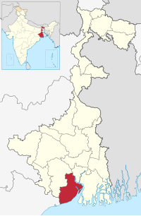 | |
| ME | Paschim Medinipur | Medinipur | 2002[5] | 6,308 km2 (2,436 sq mi) | 5,943,300 | 636/km2 (1,650/sq mi) |  | |
| PU | Purulia | Purulia | 1956 | 6,259 km2 (2,417 sq mi) | 2,927,965 | 468/km2 (1,210/sq mi) |  | |
| BN | Bankura | Bankura | 1947 | 6,882 km2 (2,657 sq mi) | 3,596,292 | 523/km2 (1,350/sq mi) |  | |
| JH | Jhargram | Jhargram | 2017[7] | 3,037.64 km2 (1,172.84 sq mi) | 1,136,548 | 374/km2 (970/sq mi) |  | |
| Total | 5 | — | - | 15 | 27,223 km2 (10,511 sq mi) | 18,672,669 |
686/km2 (1,780/sq mi) |
 |
Demographics
[edit]Hindus form the majority of the population of Medinipur division and comprises 82.3% of the population. There is a significant population of various tribes in this division such as Kudmi, Santhal, Munda, etc. Muslims comprises 10.1% of the population.[8]
References
[edit]- ^ a b "Fact and Figures". Wb.gov.in. Retrieved 5 July 2019.
- ^ "52nd Report of the Commissioner for Linguistic Minorities in India" (PDF). Nclm.nic.in. Ministry of Minority Affairs. p. 85. Archived from the original (PDF) on 25 May 2017. Retrieved 5 July 2019.
- ^ "Bengal to be divided into two more administrative divisions". 23 November 2016.
- ^ "Directory of District, Sub division, Panchayat Samiti/ Block and Gram Panchayats in West Bengal, March 2008". West Bengal. National Informatics Centre, India. 19 March 2008. p. 1. Archived from the original on 25 February 2009. Retrieved 2009-02-28.
- ^ a b Jana, Naresh (31 December 2001). "Tamluk readies for giant's partition". The Telegraph (Kolkata). Archived from the original on 14 March 2014. Retrieved 1 September 2008.
- ^ http://aitcofficial.org/aitc/bengal-chief-minister-sub-division-purulia-manbazar-jhalda/
- ^ "Brief History of Cooch Behar". Official website of Cooch Behar District. Archived from the original on 24 July 2011. Retrieved 10 September 2008.
- ^ Population by religious community: West Bengal. 2011 Census of India.
This article about a location in West Bengal is a stub. You can help Wikipedia by expanding it. |