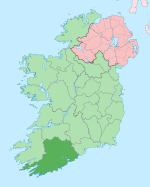
Lyre, County Cork
Lyre
An Ladhar (Irish) | |
|---|---|
Village | |
| Coordinates: 52°04′54.12″N 08°51′32.00″W / 52.0817000°N 8.8588889°W | |
| Country | Ireland |
| Province | Munster |
| County | County Cork |
| Population | |
• Total | 169 |
| Time zone | UTC+0 (WET) |
| • Summer (DST) | UTC-1 (IST (WEST)) |
Lyre (Irish: An Ladhar)[2] is a townland and small village in the civil parish of Clonmeen, barony of Duhallow, northwest County Cork, Ireland. It is approximately 3 km from the village of Nad.[3] Lyre is within the Cork North-West Dáil constituency.
It is 875 feet (266 metres) above sea level. Some locals claim it to be the third highest village in Ireland, it is the highest in Cork.[citation needed]
Amenities
[edit]Lyre has a hall, a national school, a monument for hammer thrower Denis Horgan, a monument to commemorate the turn of the millennium. The local Roman Catholic church is dedicated to St. Joseph and is in the Diocese of Cloyne.[4]
Lyre GAA is the local Gaelic Athletic Association club. It has a football team which competes at levels from under 14 upwards. They compete in the Duhallow league and Ducon Cup Championship, and also the Nevin Cup.
See also
[edit]References
[edit]- ^ "Census 2022 - Small Area Population Statistics (SAPMAP Area) - Settlements - Lyre". Census 2022. Central Statistics Office.
- ^ "Placenames Database of Ireland". Retrieved 23 September 2012.
- ^ "Lyre". IRD Duhallow. Retrieved 23 September 2012.
- ^ "Parish: Banteer (Clonmeen)". cloynediocese.ie. Cloyne Diocese. Retrieved 17 April 2020.

