Fuyuan River
Appearance
| Fuyuan River | |
|---|---|
Fuyuan River in the Fuyuan National Forest Recreation Area | |
| Location | |
| Country | Taiwan |
| Physical characteristics | |
| Source | |
| • location | Dan Mountain |
| Mouth | |
• location | Xiuguluan River |
• coordinates | 23°29′31″N 121°24′25″E / 23.492°N 121.407°E |
| Length | 28.8 km (17.9 mi) |
| Basin size | 186.90 km2 (72.16 sq mi) |
| Discharge | |
| • maximum | 2,540 m3/s (90,000 cu ft/s) |
| Basin features | |
| River system | Xiuguluan River basin |
| Waterfalls | Fuyuan Waterfall |
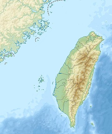
The Fuyuan River (Chinese: 富源溪; pinyin: Fùyuán Xī) is a tributary of the Xiuguluan River in Taiwan.[1][2] Originating from the Dan Mountain, it flows through Hualien County for 28 km (passing through Fuyuan National Forest Recreation Area) before joining Xiuguluan River in Ruisui, Hualien.[1][3]
See also
[edit]References
[edit]- ^ a b "Xiuguluan River basin". River System Introduction (in Chinese). The Ninth River Management Office, Water Resources Agency, Ministry of Economic Affairs. Archived from the original on 5 March 2016. Retrieved 5 May 2016.
- ^ "GeoNames Search". Geographic Names Database. National Geospatial-Intelligence Agency, USA. Retrieved 5 May 2016.
- ^ "Fuyuan Forest Recreation Area". Forest Recreation Areas. Forestry Bureau, Council of Agriculture (Republic of China). Retrieved 5 May 2016.
