Brackenridge Park
| Brackenridge Park | |
|---|---|
 Dionicio Rodriguez Bridge in Brackenridge Park | |
 | |
| Type | public park |
| Location | 3700 N. St. Mary's Street San Antonio, Texas 78209 |
| Coordinates | 29°27′21″N 98°28′23″W / 29.4557876°N 98.473072°W [1] |
| Area | 343.7 acres (1.391 km2) |
| Created | 1899 |
| Operated by | San Antonio Parks and Recreation Department |
| NRHP reference No. | 11000513 |
| Added to NRHP | August 4, 2011[2] |
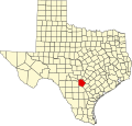
Brackenridge Park is a 343.7-acre public park (139.1 ha) in San Antonio, Texas, United States, on the city's Broadway Corridor just north of downtown San Antonio.
Brackenridge Park also refers to the district of the city where the park is located.
History
[edit]It was created in 1899 from land donated to the city by George Washington Brackenridge.
Recreation and features
[edit]
Attractions within the park include the San Antonio Zoo, the Witte Museum, the Japanese Tea Gardens, the Sunken Garden Theater, the Tuesday Musical Club, First Tee of San Antonio and the 2 ft (610 mm) narrow gauge San Antonio Zoo Eagle train ride, which first opened in 1956.[3] Other nearby attractions include the DoSeum and the San Antonio Botanical Garden.
Inside the park, there are multiple baseball fields, playgrounds, pavilions, and walking trails.
See also
[edit]- Acequia Madre de Valero (San Antonio)
- Dionicio Rodriguez
- San Antonio Japanese Tea Garden
- Fountain at Alamo Cement Company
- Fence at Alamo Cement Company
- Brackenridge Park Golf Course
- Brackenridge Park Bridge
References
[edit]- ^ "Brackenridge Park". Geographic Names Information System. United States Geological Survey. Retrieved January 11, 2010.
- ^ "Brackenridge Park Historic District - National Register of Historic Places Registration Form". National Archives Catalog. National Park Service. August 8, 2011. Archived from the original on April 20, 2021. Retrieved April 20, 2021.
- ^ San Antonio Zoo - Zoo Train
External links
[edit]
- Parks in Texas
- Tourist attractions in San Antonio
- Parks in San Antonio
- Protected areas of Bexar County, Texas
- National Register of Historic Places in San Antonio
- Parks on the National Register of Historic Places in Texas
- National Park Service rustic in Texas
- Central Texas geography stubs
- Texas Registered Historic Place stubs
