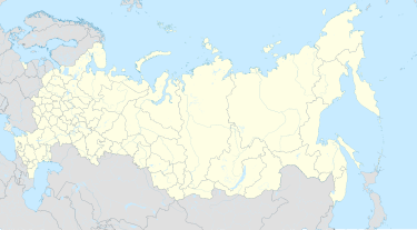
Beyni
Beyni
Бейни | |
|---|---|
| Other transcription(s) | |
| Coordinates: 42°50′03″N 44°43′01″E / 42.834193°N 44.717048°E | |
| Country | Russia |
| Federal subject | Ingushetia |
| Population | |
• Total | 70 |
| • Capital of | Dzheyrakhsky District[2] |
| Time zone | UTC+3 (MSK |
| Postal code(s)[4] | 386430 |
| Dialing code(s) | +7 8734 |
| OKTMO ID | 26620440101 |
Beyni (Russian: Бейни; Ingush: Бейни, Bejni) - is a village and administrative center of Beyni rural settlement in Dzheyrakhsky District of the Republic of Ingushetia, Russia.[6]
Geography
[edit]Beyni is situated northeast from the administrative center of the district - Dzheyrakh village. The closest inhabited localities is Lyazhgi, Olgetti and Guli southeastward, and Armkhi is situated southwestward [7]
History
[edit]Beyni was established not later than the 16th century. The village was abandoned after the forced deportation of the entire Ingush population in 1944 and resettled when the deportees were allowed to return in 1957. Beyni has a touristic tent map, and is a starting point for a popular hike trail, and shortest way to Stolovaya Mountain (Ingush: Маьт-Лоам).
Infrastructure
[edit]- Beyni municipal elementary school.[8]
References
[edit]- ^ Russian Federal State Statistics Service (2011). Всероссийская перепись населения 2010 года. Том 1 [2010 All-Russian Population Census, vol. 1]. Всероссийская перепись населения 2010 года [2010 All-Russia Population Census] (in Russian). Federal State Statistics Service.
- ^ Закон РИ от 23 февраля 2009 года № 5-РЗ «Об установлении границ муниципальных образований Республики Ингушетия и наделении их статусом сельского поселения, муниципального района и городского округа» Archived 2013-10-17 at the Wayback Machine (Law of the Republic of Ingushetia as of February 23, 2009 № 5-РЗ «On establishing boundaries of municipal localities of the Republic of Ingushetia and issuing them statuses of a rural settlement, municipal district and urban district.»)
- ^ "Об исчислении времени". Официальный интернет-портал правовой информации (in Russian). 3 June 2011. Retrieved 19 January 2019.
- ^ Почта России. Информационно-вычислительный центр ОАСУ РПО. (Russian Post). Поиск объектов почтовой связи (Postal Objects Search) (in Russian)
- ^ Закон РИ от 23 февраля 2009 года № 5-РЗ «Об установлении границ муниципальных образований Республики Ингушетия и наделении их статусом сельского поселения, муниципального района и городского округа» Archived 2013-10-17 at the Wayback Machine (Law of the Republic of Ingushetia as of February 23, 2009 № 5-РЗ «On establishing boundaries of municipal localities of the Republic of Ingushetia and issuing them statuses of a rural settlement, municipal district and urban district.»)
- ^ Закон РИ от 23 февраля 2009 года № 5-РЗ «Об установлении границ муниципальных образований Республики Ингушетия и наделении их статусом сельского поселения, муниципального района и городского округа» Archived 2013-10-17 at the Wayback Machine (Law of the Republic of Ingushetia as of February 23, 2009 № 5-РЗ «On establishing boundaries of municipal localities of the Republic of Ingushetia and issuing them statuses of a rural settlement, municipal district and urban district.»)
- ^ "Карта Чечни и Ингушетии". c. 1995. Archived from the original (rar) on 2012-03-08. Retrieved 2010-01-02. Объём 8 МБ. (Map of Chechnya and Ingushetiya)
- ^ МУЧ 'НАЧАЛЬНАЯ ШКОЛА С. БЕЙНИ' , 0607001580 Municipal elementary general education school of Beyni


