<nowiki>Gersthofen; Gersthofen; Gersthofen; Gersthofen; Gersthofen; Gersthofen; Gersthofen; گرشتهوفن; 格尔斯托芬; Gersthofen; Gersthofen; 格爾斯托芬; Gersthofen; Герстгофен; Герстхофен; 格爾斯托芬; Gersthofen; Gersthofen; Gersthofen; Герстхофен; Gersthofen; Gersthofen; Gersthofen; Gersthofen; Gersthofen; Gersthofen; Gersthofen; Герстхофен; Gersthofen; Герстхофен; Gersthofen; Gersthofen; Gersthofen; قرشتهوفن; Gersthofen; Gersthofenas; Gersthofen; Գերստհոֆեն; Gersthofen; Gersthofen; Gersthofen (munisipyo); Gersthofen; Герстхофен; Gersthofen; ゲルストホーフェン; Gersthofen; Герстхофен; Gersthofen; Gersthofen; غيرستهوفن; 格尔斯托芬; Gersthofen; città tedesca; település Németországban; Gemeinde in Deutschland; município em Baviera, Alemanha; komunë në Gjermani; Bajarokekî Almanyayê; ドイツ、バイエルン州アウクスブルク郡の市; kota di Jerman; Miasto w Niemczech; громада в Німеччині, федеральна земля Баварія; gemeente in Beieren; kumun alaman; commune allemande; بلدية ألمانية في ولاية بافاريا; chemun de la Germania; municipality of Germany; komunumo en Bavario, Germanio; sídlo ve spolkové zemi Bavorsko v Německu; město w Bayerskej; Герстҳофен; Gerstxofen; Герстхофен; Gersthofen</nowiki>
-
-
Rathaus
-
Bahnhofstraße mit Ballonmuseum
-
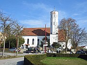
Kirche St. Jakobus
-
Kirchplatz
-
Stadthalle
-
-
Europaweiher
-
Batzenhofen an der Schmutter
-
Wullenwever-Antenne / Circularly Disposed Antenna Array (BND-Außenstelle Gablingen)


