Category:Sudeley
Jump to navigation
Jump to search
civil parish in Tewkesbury, Gloucestershire, England | |||||
| Upload media | |||||
| Instance of | |||||
|---|---|---|---|---|---|
| Location | Tewkesbury, Gloucestershire, South West England, England | ||||
| Population |
| ||||
 | |||||
English: Sudeley is a village and civil parish in the Tewkesbury district, in the county of Gloucestershire, England.
Subcategories
This category has the following 4 subcategories, out of 4 total.
C
S
Media in category "Sudeley"
The following 200 files are in this category, out of 277 total.
(previous page) (next page)-
A field for cattle grazing - geograph.org.uk - 4683373.jpg 6,000 × 4,000; 5.19 MB
-
A glimpse of the lake - geograph.org.uk - 2008848.jpg 4,000 × 3,000; 4.14 MB
-
A root crop in a field - geograph.org.uk - 5513751.jpg 1,024 × 683; 263 KB
-
Access lane to Holt Farm - geograph.org.uk - 2877573.jpg 3,264 × 2,448; 2.83 MB
-
Across Beesmoor Brook - geograph.org.uk - 1701178.jpg 4,000 × 3,000; 5.86 MB
-
Across the field - geograph.org.uk - 1701142.jpg 4,000 × 3,000; 3.64 MB
-
Across the field - geograph.org.uk - 2010235.jpg 4,000 × 3,000; 2.59 MB
-
Across the pasture - geograph.org.uk - 2008854.jpg 4,000 × 3,000; 2.73 MB
-
Across the stream - geograph.org.uk - 2010232.jpg 4,000 × 3,000; 5.08 MB
-
Across the track - geograph.org.uk - 2010236.jpg 4,000 × 3,000; 3.78 MB
-
Across the valley - geograph.org.uk - 2007312.jpg 4,000 × 3,000; 2.36 MB
-
Adventure play at Spoonley Farm - geograph.org.uk - 2878315.jpg 3,264 × 2,448; 2.84 MB
-
Alders along the Beesmoor Brook - geograph.org.uk - 2764466.jpg 640 × 480; 83 KB
-
All sorts of ways - geograph.org.uk - 2767503.jpg 4,320 × 3,240; 4.78 MB
-
Along the edge of the wood - geograph.org.uk - 2008851.jpg 4,000 × 3,000; 3.61 MB
-
Along the edge of the wood - geograph.org.uk - 2008863.jpg 4,000 × 3,000; 3.17 MB
-
Along the fence - geograph.org.uk - 2010241.jpg 4,000 × 3,000; 2.36 MB
-
Along the field edge - geograph.org.uk - 2007267.jpg 4,000 × 3,000; 3.59 MB
-
Alpacas at Sudeley Castle - geograph.org.uk - 4683375.jpg 5,495 × 3,664; 4.29 MB
-
Barley field above Humblebee Cottages - geograph.org.uk - 4643116.jpg 6,000 × 4,000; 5.22 MB
-
Beesmoor Brook - geograph.org.uk - 2877604.jpg 3,264 × 2,448; 3.51 MB
-
Beesmoor Brook pool - geograph.org.uk - 2877623.jpg 3,264 × 2,448; 3.75 MB
-
Belas Knap - geograph.org.uk - 4643166.jpg 6,000 × 4,000; 6.04 MB
-
Belas Knap Long Barrow - geograph.org.uk - 4819758.jpg 1,492 × 995; 328 KB
-
Bridge over the Beesmoor Brook - geograph.org.uk - 2764461.jpg 640 × 480; 99 KB
-
Bridleway to Hank's Gorse - geograph.org.uk - 4228644.jpg 1,920 × 1,360; 799 KB
-
Castle and town - geograph.org.uk - 2767803.jpg 4,320 × 3,240; 4.47 MB
-
Change sides - geograph.org.uk - 2007273.jpg 4,000 × 3,000; 2.61 MB
-
Copse by Corndean Lane - geograph.org.uk - 6313674.jpg 1,920 × 1,280; 1,001 KB
-
Cotehay - geograph.org.uk - 2010256.jpg 4,000 × 3,000; 2.76 MB
-
Cotehay Farm Cottages - geograph.org.uk - 2010260.jpg 4,000 × 3,000; 2.39 MB
-
Cotswold Landscape - geograph.org.uk - 1735526.jpg 640 × 426; 52 KB
-
Cotswold Way (also Winchcombe Way) west of Belas Knap - geograph.org.uk - 4956873.jpg 1,600 × 1,200; 713 KB
-
Cotswold Way - geograph.org.uk - 4291365.jpg 800 × 531; 133 KB
-
Cotswold Way 029 - geograph.org.uk - 3712438.jpg 640 × 480; 84 KB
-
Cottages at Cotehay - geograph.org.uk - 2007270.jpg 4,000 × 3,000; 2.6 MB
-
Cows by the Windrush Way - geograph.org.uk - 4683369.jpg 6,000 × 4,000; 5.68 MB
-
Derelict waterwheel - geograph.org.uk - 3074326.jpg 3,240 × 4,320; 5.11 MB
-
Disused quarry - geograph.org.uk - 2767835.jpg 4,320 × 3,240; 4.82 MB
-
Down the bank (1) - geograph.org.uk - 2007299.jpg 4,000 × 3,000; 3.74 MB
-
Down the bank (2) - geograph.org.uk - 2007302.jpg 4,000 × 3,000; 4.44 MB
-
East along the Wardens Way - geograph.org.uk - 3621773.jpg 640 × 480; 254 KB
-
End of the path - geograph.org.uk - 2010243.jpg 4,000 × 3,000; 3.45 MB
-
Entrance to Sudeley Castle - geograph.org.uk - 4576546.jpg 1,463 × 1,000; 668 KB
-
Evening at Sudeley - geograph.org.uk - 3621753.jpg 640 × 480; 241 KB
-
Farm buildings near Sudeley Lodge - geograph.org.uk - 1703500.jpg 4,000 × 3,000; 1.67 MB
-
Farm drive - geograph.org.uk - 2010263.jpg 4,000 × 3,000; 3.61 MB
-
Farm track on Cole's Hill - geograph.org.uk - 4682242.jpg 6,000 × 4,000; 4.68 MB
-
Farm track to Wontley Farm - geograph.org.uk - 3430249.jpg 800 × 600; 143 KB
-
Farm track to Wontley Farm - geograph.org.uk - 3430250.jpg 800 × 600; 156 KB
-
Field below Bespidge Wood - geograph.org.uk - 4681975.jpg 6,000 × 4,000; 5.39 MB
-
Field in Charlton Abbots - geograph.org.uk - 6313664.jpg 1,920 × 1,280; 818 KB
-
Field in Charlton Abbots - geograph.org.uk - 6313669.jpg 1,920 × 1,280; 1.56 MB
-
Field of oats near Belas Knap - geograph.org.uk - 4643178.jpg 6,000 × 4,000; 4.45 MB
-
Fields below Newmeadow Farm - geograph.org.uk - 4683361.jpg 6,000 × 4,000; 3.82 MB
-
Footpath meets road - geograph.org.uk - 2010255.jpg 4,000 × 3,000; 2.51 MB
-
Footpath to Charlton Abbots - geograph.org.uk - 2007281.jpg 4,000 × 3,000; 1.74 MB
-
Footpath to Winchcombe - geograph.org.uk - 4682253.jpg 6,000 × 4,000; 4.19 MB
-
Former pig pens by Waterhatch Mill - geograph.org.uk - 2901182.jpg 640 × 480; 135 KB
-
Fuel no more - geograph.org.uk - 2008878.jpg 3,000 × 4,000; 3.44 MB
-
Gallery View - geograph.org.uk - 1701794.jpg 4,000 × 3,000; 2.58 MB
-
Garden at Sudeley Castle - geograph.org.uk - 6291595.jpg 1,024 × 768; 304 KB
-
Gate on Wardens Way - geograph.org.uk - 3621760.jpg 480 × 640; 150 KB
-
Gloucestershire farmland - geograph.org.uk - 2007268.jpg 4,000 × 3,000; 3.03 MB
-
Gloucestershire farmland - geograph.org.uk - 2010225.jpg 4,000 × 3,000; 2.66 MB
-
Good thing there's a gate - geograph.org.uk - 2764471.jpg 640 × 480; 121 KB
-
Goodwell Farm - geograph.org.uk - 2010240.jpg 4,000 × 3,000; 2.24 MB
-
Green trees and green grain - geograph.org.uk - 3081807.jpg 4,320 × 3,240; 4.24 MB
-
Handsome Chap - geograph.org.uk - 4840774.jpg 1,503 × 1,025; 967 KB
-
Hank's Gorse - geograph.org.uk - 2010251.jpg 4,000 × 3,000; 2.92 MB
-
Hank's Gorse - geograph.org.uk - 4228632.jpg 1,920 × 1,353; 742 KB
-
Harvested field by No Man's Patch - geograph.org.uk - 4683372.jpg 6,000 × 4,000; 5.63 MB
-
Heading towards Breakheart Plantation - geograph.org.uk - 3430208.jpg 800 × 600; 137 KB
-
Heading towards Breakheart Plantation - geograph.org.uk - 3430239.jpg 800 × 600; 145 KB
-
Hill in Charlton Abbots - geograph.org.uk - 6315250.jpg 1,920 × 1,280; 923 KB
-
Hillside barley field - geograph.org.uk - 4641974.jpg 6,000 × 4,000; 4.01 MB
-
Hilltop junction - geograph.org.uk - 2767879.jpg 4,320 × 3,240; 5.05 MB
-
Holt Farm - geograph.org.uk - 2008847.jpg 4,000 × 3,000; 2.24 MB
-
Holt Farm access lane leaves the road to Roel Gate - geograph.org.uk - 2877555.jpg 3,264 × 2,448; 2.82 MB
-
Holt Farm Cottages - geograph.org.uk - 2007296.jpg 4,000 × 3,000; 3.05 MB
-
Horse jump on the Salt Way - geograph.org.uk - 2878339.jpg 3,264 × 2,448; 3.57 MB
-
Horse jumps south of Roel Gate - geograph.org.uk - 2878392.jpg 3,264 × 2,448; 2.83 MB
-
House in Brockhampton - geograph.org.uk - 6313395.jpg 1,875 × 1,250; 1.04 MB
-
House on Cole's Hill - geograph.org.uk - 1701220.jpg 4,000 × 3,000; 3.94 MB
-
Houses at Oxleaze - geograph.org.uk - 1735527.jpg 640 × 426; 74 KB
-
Houses for horses - geograph.org.uk - 2010244.jpg 4,000 × 3,000; 2.79 MB
-
Humblebee - geograph.org.uk - 4229705.jpg 1,920 × 1,150; 869 KB
-
Hydraulic ram - geograph.org.uk - 2008840.jpg 4,000 × 3,000; 3.54 MB
-
Into the valley - geograph.org.uk - 2008846.jpg 4,000 × 3,000; 3.74 MB
-
Lane in Charlton Abbots - geograph.org.uk - 6313790.jpg 1,920 × 1,280; 1.32 MB
-
Lane north of Brockhampton - geograph.org.uk - 6313808.jpg 1,862 × 1,240; 1.27 MB
-
Lane to Brockhampton - geograph.org.uk - 4229251.jpg 1,920 × 1,325; 649 KB
-
Lane to West Wood - geograph.org.uk - 4217842.jpg 1,920 × 1,440; 854 KB
-
Lane to West Wood - geograph.org.uk - 4228692.jpg 1,920 × 2,395; 1.26 MB
-
Lane to Westwood House - geograph.org.uk - 1333516.jpg 426 × 640; 90 KB
-
Lane to Winchcombe - geograph.org.uk - 4217821.jpg 1,920 × 2,560; 1.73 MB
-
Lane's Barn - geograph.org.uk - 1701124.jpg 4,000 × 3,000; 2.17 MB
-
Lanes End Cottage - geograph.org.uk - 2010242.jpg 4,000 × 3,000; 2.69 MB
-
Laying a new gas pipeline near Hawling - geograph.org.uk - 2813730.jpg 3,814 × 2,543; 2.81 MB
-
Leaving the woods - on Wardens Way - geograph.org.uk - 3621787.jpg 640 × 480; 462 KB
-
Left or right - geograph.org.uk - 2007276.jpg 4,000 × 3,000; 2.97 MB
-
Lily pond and ruined Tithe Barn, Sudeley Castle - geograph.org.uk - 6260883.jpg 1,024 × 768; 1.27 MB
-
Limekiln Plantation (1) - geograph.org.uk - 2767544.jpg 4,320 × 3,240; 5.1 MB
-
Limekiln Plantation (2) - geograph.org.uk - 2767555.jpg 4,320 × 3,240; 5.09 MB
-
Lone tree in a barley field - geograph.org.uk - 2521042.jpg 1,024 × 768; 126 KB
-
-
Long grass on the verge, barley in the field - geograph.org.uk - 2521033.jpg 1,024 × 768; 160 KB
-
Longbarrow Bank - geograph.org.uk - 2520877.jpg 1,024 × 768; 115 KB
-
Looking north from the top of Belas Knap - geograph.org.uk - 4956882.jpg 1,600 × 1,200; 716 KB
-
Looking south from Belas Knap barrow - geograph.org.uk - 4956885.jpg 1,200 × 1,600; 732 KB
-
Looking towards Waterhatch from near Spoonley Farm house - geograph.org.uk - 2878320.jpg 3,264 × 2,448; 3.46 MB
-
Low-flying aircraft near Winchcombe - geograph.org.uk - 4683371.jpg 6,000 × 4,000; 5.83 MB
-
Manor House - geograph.org.uk - 2010246.jpg 4,000 × 3,000; 3.26 MB
-
Meeting of paths below Limekiln Plantation - geograph.org.uk - 4684940.jpg 6,000 × 4,000; 4.7 MB
-
Meeting of tracks below Spoonley Farm - geograph.org.uk - 4682241.jpg 6,000 × 4,000; 6.14 MB
-
Memorial bench - Roel Gate - geograph.org.uk - 2878381.jpg 3,054 × 2,392; 461 KB
-
Mill pond - geograph.org.uk - 3074247.jpg 4,320 × 3,240; 5.25 MB
-
Mown path - geograph.org.uk - 2010254.jpg 4,000 × 3,000; 3.18 MB
-
New plantation - geograph.org.uk - 1701164.jpg 4,000 × 3,000; 4.86 MB
-
Newly laid hedge near Charlton Abbotts - geograph.org.uk - 2877540.jpg 3,264 × 2,448; 3.11 MB
-
Oak tree at Sudeley - geograph.org.uk - 1112832.jpg 426 × 640; 109 KB
-
Old wall south of Roel Gate - geograph.org.uk - 2878330.jpg 3,264 × 2,448; 3.1 MB
-
On top of Round Hill - geograph.org.uk - 2767865.jpg 4,320 × 3,240; 5.03 MB
-
Open field above Parks Farm - geograph.org.uk - 4685484.jpg 6,000 × 4,000; 5.16 MB
-
Outlying buildings - geograph.org.uk - 2010233.jpg 4,000 × 3,000; 2.62 MB
-
Overgrown path - geograph.org.uk - 2008850.jpg 4,000 × 3,000; 4.49 MB
-
Parks Farm - geograph.org.uk - 1703424.jpg 4,000 × 3,000; 2.5 MB
-
Pass the tree - geograph.org.uk - 2007350.jpg 4,000 × 3,000; 2.92 MB
-
Passing place on the Salt Way - geograph.org.uk - 2521054.jpg 1,024 × 768; 148 KB
-
Path by a wheat field - geograph.org.uk - 4684902.jpg 6,000 × 4,000; 5.37 MB
-
Path leaves bridleway - geograph.org.uk - 1703489.jpg 4,000 × 3,000; 2.42 MB
-
Path leaves the track - geograph.org.uk - 1701136.jpg 4,000 × 3,000; 1.59 MB
-
Path through Spoonley Woods - geograph.org.uk - 2878303.jpg 2,448 × 3,264; 3.64 MB
-
Path through the grounds of Sudeley Castle - geograph.org.uk - 4683376.jpg 6,000 × 4,000; 6.02 MB
-
Path to Charlton Abbots Church - geograph.org.uk - 2877615.jpg 2,448 × 3,264; 3.67 MB
-
Pile of logs near Waterhatch - geograph.org.uk - 4682251.jpg 6,000 × 4,000; 5.74 MB
-
Pipeline markers along the field boundary - geograph.org.uk - 2521047.jpg 1,024 × 768; 137 KB
-
Pipeline ready for burial next to Oxleaze Wood - geograph.org.uk - 2813718.jpg 3,345 × 2,230; 2.95 MB
-
Pond in the Queen's Garden, Sudeley - geograph.org.uk - 5775771.jpg 1,024 × 680; 336 KB
-
Pool Covert - geograph.org.uk - 4228621.jpg 1,914 × 1,171; 718 KB
-
Reservoir near Lane's Barn - geograph.org.uk - 1701127.jpg 4,000 × 3,000; 2.54 MB
-
Rhodes family tomb - geograph.org.uk - 2008845.jpg 3,000 × 4,000; 3.97 MB
-
Road by the wood - geograph.org.uk - 3081716.jpg 4,320 × 3,240; 4.97 MB
-
Road side reservoir - geograph.org.uk - 3081498.jpg 4,320 × 3,240; 5.01 MB
-
Road to Charlton Abbots - geograph.org.uk - 4228610.jpg 1,920 × 1,387; 1.15 MB
-
Roel Camp (1) - geograph.org.uk - 3081481.jpg 4,320 × 3,240; 4.83 MB
-
Roel Camp (2) - geograph.org.uk - 3081489.jpg 4,320 × 3,240; 5.06 MB
-
Roel Gate - geograph.org.uk - 3081391.jpg 4,320 × 3,240; 5.12 MB
-
Roel Gate - geograph.org.uk - 6313809.jpg 1,920 × 1,280; 982 KB
-
Ruined watermill, Waterhatch - geograph.org.uk - 2877645.jpg 2,448 × 3,264; 3.73 MB
-
Semi derelict - geograph.org.uk - 3081812.jpg 4,320 × 3,240; 4.5 MB
-
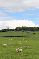
Sheep grazing land above Sudeley Lodge - geograph.org.uk - 4685443.jpg 6,000 × 4,000; 4.55 MB
-
Sheep grazing land above Sudeley Lodge - geograph.org.uk - 4685455.jpg 6,000 × 4,000; 5.53 MB
-
Sheep grazing near Charlton Abbots - geograph.org.uk - 5397693.jpg 3,456 × 5,184; 6.09 MB
-
Sheep in a barley field near Belas Knap - geograph.org.uk - 4643137.jpg 6,000 × 4,000; 5.37 MB
-
Sheep in Charlton Abbots - geograph.org.uk - 6313660.jpg 1,920 × 1,280; 1.19 MB
-
Sheep in long grass - geograph.org.uk - 4643189.jpg 6,000 × 4,000; 3.48 MB
-
Sheep near Sudeley Lodge - geograph.org.uk - 4684916.jpg 6,000 × 4,000; 4.26 MB
-
Sign on the Cotswold Way - geograph.org.uk - 2739423.jpg 680 × 1,024; 353 KB
-
Soil erosion at Sudeley - geograph.org.uk - 1112835.jpg 640 × 426; 107 KB
-
Some roof repairs required - geograph.org.uk - 3074332.jpg 3,264 × 2,448; 3.09 MB
-
Spoonley Farm House - geograph.org.uk - 4682234.jpg 5,806 × 3,871; 4.08 MB
-
Spoonley House - geograph.org.uk - 1701719.jpg 4,000 × 3,000; 3.54 MB
-
Spoonley Wood (1) - geograph.org.uk - 1701206.jpg 4,000 × 3,000; 3.96 MB
-
Spoonley Wood (2) - geograph.org.uk - 1701213.jpg 4,000 × 3,000; 4.01 MB
-
St Mary's Chapel, Sudeley - geograph.org.uk - 6291522.jpg 1,024 × 768; 282 KB
-
St Mary's Chapel, Sudeley - geograph.org.uk - 6291525.jpg 768 × 1,024; 270 KB
-
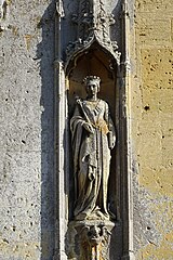
Statue of Henry VI - geograph.org.uk - 6292207.jpg 683 × 1,024; 292 KB
-
Statue of Queen Margaret of Anjou - geograph.org.uk - 6292224.jpg 683 × 1,024; 303 KB
-
Statues on the west front of St Mary's Chapel - geograph.org.uk - 6292245.jpg 1,024 × 768; 312 KB
-
Steps down from Holt Farm Cottages - geograph.org.uk - 2877599.jpg 3,264 × 2,448; 3.56 MB
-
Sudeley - Tomb of Katherine Parr (1512-1548) - geograph.org.uk - 4678430.jpg 1,333 × 1,000; 1,012 KB
-
Sudeley Castle - Alpacas - geograph.org.uk - 4678600.jpg 1,183 × 1,000; 836 KB
-
Sudeley Castle - Gardens - geograph.org.uk - 4678584.jpg 1,428 × 1,000; 1,008 KB
-
Sudeley Castle - geograph.org.uk - 4830108.jpg 1,692 × 1,114; 1.05 MB
-
Sudeley Castle - geograph.org.uk - 5773993.jpg 1,024 × 680; 271 KB
-
Sudeley Castle - geograph.org.uk - 5775766.jpg 1,024 × 680; 341 KB
-
Sudeley Castle - geograph.org.uk - 5775768.jpg 1,024 × 680; 320 KB
-
Sudeley Castle - geograph.org.uk - 5796632.jpg 6,248 × 4,171; 4.53 MB
-
Sudeley Castle - geograph.org.uk - 6291527.jpg 1,024 × 768; 265 KB
-
Sudeley Castle - geograph.org.uk - 6291590.jpg 1,024 × 768; 293 KB
-
Sudeley Castle - Lily pond reflecting the Tithe Barn - geograph.org.uk - 4678646.jpg 1,000 × 1,333; 1.2 MB
-
Sudeley Castle - Reflected Tithe Barn - geograph.org.uk - 4678630.jpg 1,333 × 1,000; 1.43 MB
-
Sudeley Castle - Ruins of banqueting hall - geograph.org.uk - 4678266.jpg 1,000 × 1,333; 1.1 MB
-
Sudeley Castle - St Mary's church - geograph.org.uk - 4678400.jpg 1,283 × 1,000; 1.11 MB
-
Sudeley Castle - Tithe Barn - geograph.org.uk - 4678610.jpg 1,333 × 1,000; 1.27 MB
-
Sudeley Castle - Tithe Barn - Interior (NE end) - geograph.org.uk - 4678615.jpg 1,333 × 1,000; 1.38 MB
-
Sudeley Castle - view to St Mary's church - geograph.org.uk - 4678604.jpg 1,333 × 1,000; 1.08 MB
-
Sudeley Castle - Yew Tree Walk - geograph.org.uk - 4678589.jpg 1,333 × 1,000; 1.06 MB
-
Sudeley Castle and gardens - geograph.org.uk - 5224792.jpg 640 × 625; 62 KB
-
Sudeley Castle and gardens - geograph.org.uk - 5224801.jpg 640 × 625; 57 KB
-
Sudeley Lodge - geograph.org.uk - 1703513.jpg 4,000 × 3,000; 2.61 MB
-
Sunflowers - geograph.org.uk - 2010249.jpg 4,000 × 3,000; 2.54 MB
-
The Cotswold escarpment - geograph.org.uk - 4291349.jpg 800 × 531; 140 KB
-
The Cotswold Way - geograph.org.uk - 2739403.jpg 1,024 × 680; 251 KB
-
The Cotswold Way - geograph.org.uk - 4291352.jpg 800 × 531; 166 KB
-
The east side of Belas Knap and the path around it - geograph.org.uk - 4956876.jpg 1,600 × 1,200; 750 KB
-
The entrance to Sudeley Castle - geograph.org.uk - 6312482.jpg 1,920 × 1,280; 948 KB
-
The gardens of Sudeley Castle - geograph.org.uk - 6291519.jpg 1,024 × 768; 288 KB
-
The Great Hall, Sudeley Castle - geograph.org.uk - 5774000.jpg 1,024 × 680; 327 KB