Category:Plans of Giza Necropolis
Jump to navigation
Jump to search
Subcategories
This category has only the following subcategory.
S
Media in category "Plans of Giza Necropolis"
The following 25 files are in this category, out of 25 total.
-
A Plan of the Pyramids of Gize near Cairo - Pococke Richard - 1743.jpg 670 × 1,500; 337 KB
-
163 of 'Viaje á Egipto, Palestina y otros países del Oriente' (11152311533).jpg 1,521 × 1,656; 664 KB
-
PSM V80 D456 Map of the pyramids of gizah.png 1,254 × 1,194; 225 KB
-
-
-
-
A plan ot the pyramids of Gize near Cairo - btv1b8595256d.jpg 4,233 × 8,110; 5.57 MB
-
Carte-lepsius-gizeh.jpg 3,543 × 2,816; 554 KB
-
Carte-nécropole-Gizeh-Est.jpg 1,110 × 711; 119 KB
-
Carte-nécropole-Gizeh-Ouest.jpg 1,302 × 1,507; 241 KB
-
Carte-nécropole-Gizeh-Sud.jpg 666 × 849; 81 KB
-
Carte-nécropole-khéops2 copie.jpg 1,864 × 2,849; 466 KB
-
Royal pyramid with rows of mastaba tombs behind it. (1902) - TIMEA.jpg 475 × 1,024; 64 KB
-
D203-Triangulation des Pyramides de Giseh.-L2-Ch6.png 1,485 × 1,730; 53 KB
-
Egyptian illustration from the public domain, digitally enhanced by rawpixel-com 52.jpg 1,724 × 2,500; 3.51 MB
-
Giza geo.jpg 1,325 × 1,118; 147 KB
-
Handbook of archaeology, Egyptian - Greek - Etruscan - Roman (1867) (14778115881).jpg 1,480 × 1,988; 458 KB
-
Kyzmin1.jpg 732 × 460; 153 KB
-
Lehner-Hetepheres-Plan.jpg 548 × 657; 30 KB
-
Lepsius-Projekt tw 1-1-16.jpg 1,900 × 1,576; 457 KB
-
Map of the Giza Plateau emphasizing the pyramid precincts (100m grid squares).tif 7,728 × 10,620; 9.82 MB
-
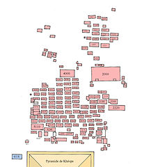
Mappa necropoli Giza.png 420 × 443; 5 KB
-
-
-