Category:Old map images that should use vector graphics
Jump to navigation
Jump to search
This is a subcategory of Category:Images that should use vector graphics. You can add images to this category using the template {{Convert to SVG|old map}}.
Media in category "Old map images that should use vector graphics"
The following 79 files are in this category, out of 79 total.
-
1946 Map of Pyongyang, Army Map Service, US Army.jpg 4,168 × 4,481; 7.74 MB
-
1986 map of ethnic groups in southern Soviet Union and neighboring Middle Eastern countries.tif 7,004 × 4,471; 89.61 MB
-
1992 map of major ethnic groups in Central Asia.tif 10,272 × 8,437; 247.97 MB
-
1french-empire1811.jpg 2,247 × 1,798; 1.58 MB
-
330-Map of the Valley of Mexico.jpg 1,040 × 1,273; 1.09 MB
-
843-870 Europe.jpg 513 × 430; 80 KB
-
Alexander's empire near India.jpg 800 × 600; 176 KB
-
Alpes.jpg 1,108 × 724; 233 KB
-
Athenian empire 450.jpg 1,094 × 906; 268 KB
-
Austria-Hungary ethnic map.jpg 1,623 × 1,276; 312 KB
-
Azores old map.jpg 2,104 × 1,480; 678 KB
-
BabylonianWorldMap2.jpg 585 × 480; 93 KB
-
Bengal and its small kingdoms, 1747 (with color) 01.jpg 4,280 × 3,600; 1.79 MB
-
Bengal and its small kingdoms, 1747 (without color).jpg 1,600 × 1,287; 705 KB
-
Bengal in 1760.jpg 2,094 × 1,502; 558 KB
-
Bengal in 1912.jpg 1,891 × 1,387; 690 KB
-
Bistum Konstanz.jpg 428 × 600; 175 KB
-
Bowen, Frances. Turkey in Asia. 1810.jpg 5,164 × 4,417; 2.53 MB
-
Brit IndianEmpireReligions3.jpg 1,534 × 1,241; 2.33 MB
-
Calcutta, 1756.png 3,392 × 1,770; 9.31 MB
-
Carte de La Nouvelle-Orléans.jpg 623 × 483; 52 KB
-
Carte de la végétation de l'Europe.png 660 × 605; 773 KB
-
Carte du Laurion antique.jpg 1,776 × 1,457; 1.21 MB
-
Chittagong in 1776.jpg 1,080 × 1,920; 388 KB
-
CityParkGolfMap1938.jpg 447 × 600; 70 KB
-
County of Salona.jpg 1,144 × 900; 434 KB
-
De Smet Council Bluffs.jpg 2,154 × 2,401; 553 KB
-
Devonport Dockyard in 1909 plan original.jpg 716 × 1,139; 194 KB
-
Dispersal of Slavs as of 1900 (1910 map).jpg 1,200 × 1,031; 212 KB
-
German Map Sudeten.PNG 407 × 636; 176 KB
-
Helmholt - Western Europe early 18th century.jpg 2,998 × 2,482; 2.69 MB
-
Hunger Map of Europe- The New York Times Current History-May 1919.png 697 × 601; 255 KB
-
IndianTerritory.jpg 1,000 × 1,061; 233 KB
-
IndiaPolitical1893ConstablesHandAtlas.jpg 1,318 × 1,027; 341 KB
-
Karte Marie Loevenich.jpg 1,460 × 1,126; 228 KB
-
Krimkhanat um 1550.jpg 760 × 425; 340 KB
-
Letts, Son & Co. Russia 9. 1883 (O).jpg 2,629 × 1,557; 3.67 MB
-
Lorraine 1000.png 488 × 572; 634 KB
-
Map of Indian Handlooms, 1985, Crafts Museum, New Delhi, India.jpg 2,504 × 3,420; 4.33 MB
-
Map of the Habsburg Netherlands by Alexis-Marie Gochet.png 532 × 744; 813 KB
-
Map of Tibet in 1909 (cropped).jpg 834 × 333; 416 KB
-
Meyer5 Frankfurt Lokalbahn.png 479 × 152; 66 KB
-
MOU-map.jpg 2,592 × 2,656; 501 KB
-
Moughan in Abbasid Caliphate.jpg 260 × 283; 23 KB
-
No Mans Land Oklahoma.jpg 800 × 526; 62 KB
-
OoNL1786.png 565 × 481; 539 KB
-
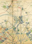
Plan STCRP n°2 de 1923 (verso) Trams à Paris.jpg 4,592 × 3,436; 13.3 MB
-
Platner - Ancient Rome city growth.jpg 750 × 729; 134 KB
-
Political Divisions of the Indian Empire, 1909.jpg 734 × 599; 165 KB
-
Polska i Litwa w 15. wieku.jpg 2,918 × 2,304; 1.52 MB
-
Polska w poczatku 12. wiek.jpg 2,178 × 1,672; 833 KB
-
Preussen-GrKF.jpg 1,266 × 601; 309 KB
-
Recife-Map1665-ForteWaerdemburch.jpg 457 × 420; 120 KB
-
Remains of Nero's Isthmus Canal in 1881 (cropped).jpg 1,191 × 487; 201 KB
-
Remains of Nero's Isthmus Canal in 1881.jpg 1,200 × 760; 225 KB
-
Rhein-Mosel-Departement 600 dpi.jpg 4,394 × 5,485; 5.43 MB
-
Rheinbach Tafelkk.jpg 592 × 415; 58 KB
-
Rheinland 1905.png 1,400 × 2,000; 1.82 MB
-
Rheinland Regierungsbezirke 1905.png 1,400 × 2,000; 1.94 MB
-
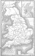
Romanbritain.jpg 854 × 1,364; 712 KB
-
Russia ethnic.JPG 1,017 × 1,253; 501 KB
-
Rzeczpospolita w 16. i 17. wieku.jpg 2,674 × 2,224; 1.39 MB
-
Römerstraßen rund um Rom.jpg 1,590 × 1,530; 1.28 MB
-
Scripts in Europe (1901).jpg 2,907 × 2,421; 1.72 MB
-
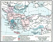
ShepherdByzempire1265.jpg 1,144 × 900; 281 KB
-
South-eastern Europe c. 1180.jpg 2,046 × 1,612; 1.87 MB
-
Srt1870.jpg 1,110 × 797; 336 KB
-
Stadtplan-Stuttgart-1893.jpg 994 × 626; 272 KB
-
Stanleyroutes.PNG 709 × 498; 92 KB
-
STCRP 1925 Nord Parisien.pdf 847 × 1,158; 6.44 MB
-
STCRP Tramways Banlieue 1921.jpg 4,566 × 3,420; 15.23 MB
-
Strategic Situation of Europe 1809.jpg 1,260 × 965; 209 KB
-
Utica1802.jpg 723 × 464; 24 KB
-
Walser Italien.JPG 1,968 × 2,121; 918 KB
-
Übersicht Der Deutschen Besitzungen im Stillen Ozean-Nauru.png 2,518 × 2,538; 4.49 MB
-
Засечная черта Московского государства в XVII веке.png 4,444 × 2,755; 2.82 MB
-
Europe in the 14th Century.jpg 1,549 × 1,134; 620 KB


