Category:Maps of the history of Telangana
Jump to navigation
Jump to search
States of India: Andhra Pradesh · Assam · Goa · Himachal Pradesh · Karnataka · Kerala · Maharashtra · Tamil Nadu · Telangana · West Bengal
Union territories: Dadra and Nagar Haveli and Daman and Diu · Delhi · Jammu and Kashmir · Ladakh · Puducherry
Former states of India:
Former union territories:
Union territories: Dadra and Nagar Haveli and Daman and Diu · Delhi · Jammu and Kashmir · Ladakh · Puducherry
Former states of India:
Former union territories:
Subcategories
This category has the following 3 subcategories, out of 3 total.
Media in category "Maps of the history of Telangana"
The following 5 files are in this category, out of 5 total.
-
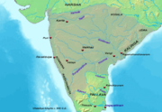
Chalukya territories lg.png 612 × 421; 105 KB
-
Extent of the Satavahanas.png 1,027 × 909; 196 KB
-
Location map of Historical Temples in Warangal.png 1,867 × 1,083; 436 KB
-
Telangana Rebellion District.svg 601 × 601; 120 KB
-
Telangana Rebellion.png 1,562 × 1,499; 205 KB


