Category:Maps of princely states of India
Jump to navigation
Jump to search
Subcategories
This category has the following 8 subcategories, out of 8 total.
Media in category "Maps of princely states of India"
The following 109 files are in this category, out of 109 total.
-
"FIGHTING CLANS" of the British Indian Empire, 1918 — North East.jpg 1,996 × 1,430; 767 KB
-
"FIGHTING CLANS" of the British Indian Empire, 1918 — North West.jpg 2,012 × 1,372; 482 KB
-
"FIGHTING CLANS" of the British Indian Empire, 1918 — South East.jpg 1,988 × 1,280; 423 KB
-
"FIGHTING CLANS" of the British Indian Empire, 1918 — South West.jpg 2,008 × 1,296; 226 KB
-
1946 map of Kathiawar Peninsula by National Geographic.jpg 908 × 592; 160 KB
-
1946 Political Subdivisions of India by National Geographic.jpg 8,584 × 7,478; 3.18 MB
-
AkalkotKart.jpg 237 × 242; 87 KB
-
AlirajpurKart.jpg 524 × 270; 158 KB
-
Alwar-karauli map.jpg 1,036 × 632; 191 KB
-
Bansda and Dharampur, 1896.jpg 1,684 × 2,595; 663 KB
-
Barwani-Dhar map.jpg 1,062 × 648; 174 KB
-
Bashar 1911.png 734 × 604; 198 KB
-
Basoda-Muhammadgarh map.jpg 1,054 × 647; 137 KB
-
Bastar-Kanker-Imperial Gazetteer.jpg 491 × 635; 148 KB
-
Benares State-Imperial Gazetteer of India.jpg 1,184 × 647; 179 KB
-
Beri-Bijna-Tori Fatehpur map.jpg 1,175 × 653; 171 KB
-
Bhopal in India.png 748 × 796; 40 KB
-
Bikaner-Jaisalmer map.jpg 907 × 627; 127 KB
-
BonaiKart (1).jpg 446 × 371; 189 KB
-
Cambay State Kaira Agency of British India 1817-1937.svg 886 × 1,027; 1.47 MB
-
Chamba Kangra Bilaspur Mandi Kulu 1911.jpeg 744 × 873; 130 KB
-
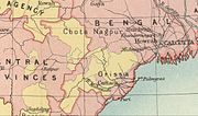
Chota Nagpur area-IGI.jpg 1,103 × 647; 148 KB
-
Chota Nagpur States-a.jpg 965 × 647; 162 KB
-
Chota Nagpur States-b.jpg 1,125 × 649; 221 KB
-
Chota Nagpur States-IGI 2.jpg 800 × 502; 121 KB
-
Colored vettattnad.jpg 3,000 × 2,233; 269 KB
-
Cooch Behar from 1931 Imperial Gazetteer.jpg 780 × 744; 527 KB
-
Daspalla-Nayagarh-Imperial Gazetteer.jpg 436 × 344; 68 KB
-
Datia-Samthar map.jpg 1,057 × 648; 158 KB
-
Dewas-Jaora map.jpg 1,045 × 647; 154 KB
-
DhenkanalKart.jpg 446 × 299; 170 KB
-
Ellichpur District-map.jpg 879 × 647; 173 KB
-
Indian princely states gun salute.svg 1,827 × 1,771; 1.49 MB
-
Indian revolt of 1857 states map de.svg 990 × 1,115; 610 KB
-
Indian revolt of 1857 states map-hu.svg 1,639 × 1,852; 347 KB
-
Indian revolt of 1857 states map.svg 1,639 × 1,852; 347 KB
-
IndoreKart.jpg 1,059 × 1,634; 135 KB
-
Jaipur-Bharatpur map.jpg 898 × 621; 168 KB
-
Jaisalmer and Neighbours.svg 800 × 650; 24 KB
-
JaitpurKart.jpg 358 × 272; 133 KB
-
Janjira-Bhor.jpg 1,102 × 628; 185 KB
-
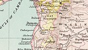
Jawhar-Dharampur map.jpg 1,114 × 629; 149 KB
-
Jhalawar-Tonk map.jpg 1,113 × 649; 188 KB
-
Jodhpur-map.jpg 844 × 607; 133 KB
-
Kalsia-Punjab-Districts 1911.png 569 × 448; 162 KB
-
Karnataka 1956 Reorg-fr.svg 672 × 746; 279 KB
-
Kawarda-Khairagarh-Imperial Gazetteer.jpg 521 × 401; 86 KB
-
Keonjhar-Rairakhol Imperial Gazetteer.jpg 649 × 493; 173 KB
-
Kolhapur 1896.jpg 2,048 × 1,295; 1.7 MB
-
Kolhapur-Jath map.jpg 1,107 × 629; 203 KB
-
KoreaKart.jpg 372 × 457; 166 KB
-
Kotah-jhalawar.PNG 582 × 500; 69 KB
-
Kothi-Bhaisunda map.jpg 1,044 × 650; 153 KB
-
Ludhiana District 1911.png 534 × 493; 111 KB
-
Mahi Kantha Agency during British India 1820-1933 with States and Thanas.png 2,000 × 1,712; 1.2 MB
-
Mahi Kantha Agency during British India 1820-1933 with States and Thanas.svg 2,269 × 1,003; 2.48 MB
-
Mahi Kantha Agency during British India 1820-1933 with States and Thanas2.png 1,404 × 868; 271 KB
-
Mahi Kantha Agency during British India 1820-1933.png 2,000 × 1,712; 1.1 MB
-
Mahi Kantha Agency during British India 1820-1933.svg 973 × 833; 2.11 MB
-
Mahi Kantha Agency in Gujarat during British India 1820-1933.svg 684 × 1,005; 2.03 MB
-
Makrai-map-1901.jpg 1,011 × 648; 174 KB
-
Map of Sailana and Ratlam States.jpg 3,210 × 2,710; 2.6 MB
-
Map of the Thanjavur Maratha kingdom.jpg 955 × 733; 77 KB
-
Map of Vindhya Pradesh.jpg 856 × 646; 99 KB
-
Nasik Agency Surgana State British India.png 2,000 × 1,712; 1.1 MB
-
Nasik Agency Surgana State in Gujarat during British India.svg 973 × 833; 2.08 MB
-
Native states of British India.jpg 2,663 × 3,233; 743 KB
-
Orchha-Panna map.jpg 1,182 × 648; 200 KB
-
Orissa Tributary States-IGI.jpg 876 × 633; 159 KB
-
Palanpur Banaskantha Agency during British India 1819-1933.svg 973 × 833; 2.09 MB
-
Palanpur Banaskantha Agency in Gujarat during British India 1819-1933.png 2,000 × 1,712; 1.1 MB
-
Palanpur Banaskantha Agency in Gujarat during British India 1819-1933.svg 684 × 948; 1.92 MB
-
Palanpuragency.png 500 × 371; 426 KB
-
Patna-Karond-Imperial Gazetteer.jpg 513 × 408; 99 KB
-
PepsuKart.jpg 876 × 1,157; 88 KB
-
Princeley-states.gif 1,621 × 1,469; 430 KB
-
Princely States and British Agencies during British India 1800-1950.svg 973 × 833; 2.07 MB
-
Punjab-Districts 1911.png 569 × 448; 113 KB
-
Rajputana occidental.PNG 810 × 800; 140 KB
-
Ratlam-map.jpg 1,022 × 646; 156 KB
-
Rewa and Singrauli.svg 313 × 392; 11 KB
-
Rewa Kantha Agency in Gujarat during British India 1811-1937 02.png 700 × 599; 235 KB
-
Rewa Kantha Agency with all Princely States Gujarat during British India 1800 - 1950.png 2,560 × 1,802; 1.37 MB
-
Rewah map.jpg 784 × 647; 128 KB
-
Sakti-Raigarh-Imperial Gazetteer.jpg 530 × 397; 70 KB
-
SaurashtraKart.jpg 480 × 487; 41 KB
-
SaurashtraKart.svg 480 × 511; 62 KB
-
Singhbum-Sairakela-Kharsawan.jpg 1,035 × 619; 161 KB
-
Sirohi-Udaipur map.jpg 906 × 633; 156 KB
-
Sitamau-Khilchipur map.jpg 1,187 × 649; 209 KB
-
Sketch map of Siba State, 1882.jpg 2,048 × 1,389; 988 KB
-
SonpurKart.jpg 422 × 319; 157 KB
-
South Indian territories-fr.svg 672 × 746; 267 KB
-
South Indian territories.svg 672 × 746; 306 KB
-
Surat Agency Gujarat during British India 1880-1933.png 2,000 × 1,712; 1.09 MB
-
Surat Agency with all princely states during British India 1880-1933 with labels.png 2,000 × 1,712; 1.1 MB
-
Surat-Sachin Map Imperial Gazetteer of India.jpg 1,179 × 649; 147 KB
-
SurgujaKart.jpg 626 × 487; 266 KB
-
Thana Agency Jawhar state British India.png 2,000 × 1,712; 858 KB
-
Thana Agency Jawhar State during British India.svg 684 × 682; 1.68 MB
-
Thana Agency Jawhar State in Gujarat during British India.svg 973 × 833; 2.07 MB
-
Tonk-map.jpg 1,055 × 647; 149 KB
-
Treaty map of India.tif 2,546 × 4,193; 983 KB
-
United Provinces 1903.png 640 × 480; 242 KB
-
Vindhya Pradesh map.jpg 856 × 646; 63 KB


