Category:Maps of Bohemia
Jump to navigation
Jump to search
Wikimedia category | |||||
| Upload media | |||||
| Instance of | |||||
|---|---|---|---|---|---|
| Category combines topics | |||||
| |||||
Subcategories
This category has the following 10 subcategories, out of 10 total.
1
- 1837 maps of Bohemia (3 F)
- 1840 maps of Bohemia (11 F)
- 1852 maps of Bohemia (5 F)
M
- Maps of regions of Bohemia (10 F)
O
Media in category "Maps of Bohemia"
The following 29 files are in this category, out of 29 total.
-
Boh-map.png 330 × 355; 25 KB
-
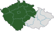
Bohemia in Czechland.svg 3,433 × 1,973; 232 KB
-
Cechy.zupy.1920.png 966 × 809; 163 KB
-
Csehország.JPG 4,320 × 3,240; 5.42 MB
-
CZ-cleneni-Cechy-wl.png 3,662 × 2,104; 695 KB
-
Der Goldene Steig.JPG 924 × 1,256; 131 KB
-
Der Goldene Steig2.png 924 × 1,256; 539 KB
-
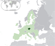
EU-Bohemia.png 2,000 × 1,682; 418 KB
-
Halle Prag Salzweg Übersichtskarte 600.jpg 696 × 700; 440 KB
-
Jagiellon Realm.png 587 × 511; 13 KB
-
Jan Erazim Vocel Čechy 8 a 9 věku tisk Mittag a Wilder.jpg 882 × 806; 222 KB
-
Karte Böhmische Krone.png 823 × 821; 104 KB
-
Karte-Nordböhmen-1912.jpg 3,192 × 2,351; 2.52 MB
-
Map for the Silesian and Seven Years Wars.jpg 1,672 × 1,238; 438 KB
-
Map of Bohemia 1618.png 1,679 × 1,369; 494 KB
-
Map of Bohemia, 1685.jpg 675 × 900; 444 KB
-
Naturraumkarte Oberlausitz.png 4,129 × 2,633; 10.13 MB
-
Pribyslavicecatasto.jpg 354 × 328; 40 KB
-
Sprachenkarte Böhmen.png 3,737 × 2,985; 1.67 MB
-
The Bohemian Realm during the Hussite Wars.png 3,187 × 2,456; 1.79 MB
-
Verwaltungsgliederung des Königreichs Böhmen 1893.svg 985 × 820; 594 KB
-
Verwaltungsgliederung Länder der Böhmischen Krone 1893.svg 1,458 × 820; 957 KB
-
Čechy do roku 1920 a změna hranice po připojení Vitorazska.png 3,662 × 2,104; 727 KB
-
Čechy okresy 1938.png 2,548 × 2,117; 324 KB
-
Čechy po roce 1920 na mapě Česka.png 3,662 × 2,104; 515 KB
-
Čechy s hranicemi české a moravské církevní provincie.png 3,662 × 2,104; 729 KB


