Category:Historical map images that should use vector graphics
Jump to navigation
Jump to search
Images composed of simple shapes, lines, and letters such as those below should be recreated using vector graphics as an SVG file. These have a number of advantages such as making it easier for subsequent editors to edit them, enabling arbitrary scaling at high quality, and sharp high-resolution renderings for print versions. See Commons:Images for cleanup for more information.
This is a subcategory of Category:Images that should use vector graphics. You can add images to this category using the template {{Convert to SVG|historical map}}.
Media in category "Historical map images that should use vector graphics"
The following 200 files are in this category, out of 1,249 total.
(previous page) (next page)-
001 Kievan Rus' Kyivan Rus' Ukraine map 1220 1240.jpg 2,301 × 2,856; 4.69 MB
-
007 Ukrainian Cossack Hetmanate and Russian Empire 1751.jpg 767 × 952; 414 KB
-
06. Operación Atila. Tarde del 20 Jul.PNG 960 × 720; 348 KB
-
1 map of Pleistocene lakes in the Great Basin.png 3,600 × 4,200; 929 KB
-
11 13th century Asia Minor Turkish Invasions.png 1,226 × 549; 641 KB
-
1236-1242 Mongol invasions of Europe.jpg 2,510 × 1,472; 3.44 MB
-
1250 Mediterranean Sea.PNG 801 × 370; 138 KB
-
128TurkomanDomin1378-1502.JPG 700 × 476; 286 KB
-
13 colonies in 1775 (large).png 442 × 655; 67 KB
-
164BeforeWWI1878-1914s.gif 700 × 473; 61 KB
-
1750 Zaporozh.png 1,615 × 1,196; 869 KB
-
175bc.jpg 579 × 258; 139 KB
-
1800 Novoros gov.jpg 1,409 × 1,094; 418 KB
-
1845 Santa Fe Trail.jpg 431 × 372; 61 KB
-
1846 Map OCRR-FRRR.jpg 5,940 × 9,460; 3.57 MB
-
1848-1899 sulu ph.jpg 640 × 435; 83 KB
-
1900azie.jpg 914 × 709; 51 KB
-
1903 Alaska boundary dispute.png 538 × 538; 16 KB
-
1973 sinai war maps2.jpg 1,165 × 894; 213 KB
-
1Empire of Theodoric the Great 523.png 523 × 478; 31 KB
-
1st century Germani.png 468 × 379; 248 KB
-
2 Jarbridge Robbery 1916.jpg 486 × 376; 23 KB
-
20060915 eltzer fehde karte.jpg 930 × 1,000; 166 KB
-
20100217005035!A view on 6th to 8th cent.jpg 977 × 852; 98 KB
-
218aC mappa del mar Mediterraneo.png 2,052 × 1,215; 997 KB
-
250 mya EARTH.png 1,018 × 624; 40 KB
-
450 roman-hunnic-empire 1764x1116.jpg 1,764 × 1,116; 3.04 MB
-
4KMACEDONIAN.png 3,840 × 2,160; 584 KB
-
506-Castile 1210.png 474 × 506; 138 KB
-
5NationsCession.jpg 450 × 443; 44 KB
-
5NationsExpansion.jpg 441 × 443; 45 KB
-
727px-NE 800ad.jpg 727 × 599; 173 KB
-
800px-Qing.PNG 1,038 × 887; 110 KB
-
81ArabAbbasidPeriod750-885.gif 700 × 456; 51 KB
-
Abbasid Khalifate.png 297 × 152; 5 KB
-
Abbasids Dynasty 750 - 1258 (AD).PNG 821 × 440; 36 KB
-
Acadie 1750.JPG 1,692 × 1,171; 536 KB
-
Acprussiamap2.gif 510 × 357; 27 KB
-
AD 750OguzYabgu.png 678 × 451; 94 KB
-
Aden Colony dependencies.png 515 × 507; 143 KB
-
Africa in 400 BC.jpg 361 × 331; 28 KB
-
Africa Orientale Italiana.png 200 × 200; 20 KB
-
Afrika Kolonisation Farben.png 982 × 991; 216 KB
-
After war-ger.JPG 387 × 599; 33 KB
-
Aftermath of Manzikert.png 800 × 369; 135 KB
-
Age of Discovery explorations in English.png 1,056 × 492; 484 KB
-
Agencies-residencies.PNG 840 × 800; 283 KB
-
Agrandissements de la France aux XIVe et XVe siècles.jpeg 591 × 584; 105 KB
-
Al Andalus & Christian Kingdoms.png 670 × 497; 106 KB
-
Al Andalus - 2.png 670 × 497; 9 KB
-
Al Andalus.png 670 × 497; 103 KB
-
Al Masudi's Map of the World.JPG 404 × 402; 29 KB
-
Alamannien Hochburgund ca 1000.png 2,500 × 2,107; 1.11 MB
-
Albani150ADRomanEmpire.png 677 × 455; 25 KB
-
Alex K Halych-Volhynia general.png 440 × 365; 38 KB
-
Alexander's Indian route.jpg 1,169 × 1,074; 168 KB
-
Alexander-Empire 323bc.jpg 2,321 × 1,288; 933 KB
-
AlexanderIndiaMap.jpg 1,112 × 1,388; 275 KB
-
Alexanderroute.gif 629 × 346; 31 KB
-
Alignment Official Pakistan map 1962.jpg 600 × 616; 59 KB
-
Alliances in Europe 1725-1730.png 3,872 × 2,761; 1.19 MB
-
Alliances in Europe 1740.png 3,872 × 2,761; 1.37 MB
-
Alliances in Europe 1748-1766.png 3,872 × 2,761; 1.38 MB
-
Allied lines of communication in Southeast Asia, 1942-43.jpg 1,260 × 970; 450 KB
-
Almohad1200.png 716 × 531; 98 KB
-
Almohads1200.png 846 × 526; 19 KB
-
Altfinnland.png 519 × 544; 144 KB
-
America 1000 BCE.png 1,407 × 2,138; 135 KB
-
American Determinist Settlements North 1770.jpg 986 × 492; 88 KB
-
Americas independence map.PNG 862 × 1,270; 74 KB
-
Amorica.JPG 294 × 184; 18 KB
-
Amphi-Rome.PNG 2,107 × 1,540; 435 KB
-
Anachronous map of the British Empire.png 1,425 × 625; 49 KB
-
Anatolia1200.png 642 × 430; 86 KB
-
Anatolian Beyliks in 1300.png 952 × 593; 345 KB
-
Ancient Egypt and Mesopotamia c. 1450 BC.png 1,200 × 1,473; 259 KB
-
Ancient Japan provinces map.jpg 800 × 1,129; 168 KB
-
Ancient thessalia.PNG 482 × 351; 129 KB
-
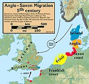
Anglo.Saxon.migration.5th.cen.jpg 1,800 × 1,703; 875 KB
-
Antik Mısır haritası.png 1,577 × 3,219; 307 KB
-
Antonine.Wall.Roman.forts.jpg 1,513 × 778; 257 KB
-
Apogée Empire Napoleon 1811.jpg 415 × 397; 18 KB
-
Aquitania 002.png 568 × 590; 256 KB
-
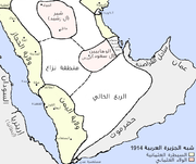
Arabia 1914-ar.png 976 × 821; 164 KB
-
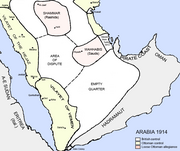
Arabia 1914.png 976 × 821; 111 KB
-
Arabia1919.jpg 900 × 925; 127 KB
-
Arabsum5.png 1,000 × 1,066; 294 KB
-
Arabsumf.png 1,000 × 1,056; 319 KB
-
Arabsumf1.png 1,000 × 1,056; 335 KB
-
Ararai 1.jpg 960 × 720; 44 KB
-
Arausio map of the Roman colonia.png 517 × 505; 23 KB
-
Arcax.jpg 1,680 × 1,196; 286 KB
-
Arctic cultures 900-1500 (no caption).png 259 × 917; 209 KB
-
Arctic cultures 900-1500 (square).png 527 × 510; 223 KB
-
Arctic cultures 900-1500.png 259 × 989; 251 KB
-
Areas annexed by Nazi Germany.png 1,111 × 745; 154 KB
-
Arkansasterritory.PNG 453 × 206; 14 KB
-
Armenia between russian and ottoman empires-ar.png 1,712 × 1,580; 98 KB
-
Armenia between russian and ottoman empires.png 1,712 × 1,580; 131 KB
-
Armenia-1916-front.jpg 2,000 × 1,303; 656 KB
-
Armenian4thcenturies.gif 699 × 456; 49 KB
-
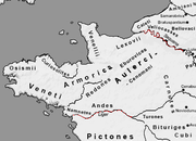
Armorica.png 395 × 286; 32 KB
-
Ashoka mauryan empire.png 400 × 337; 13 KB
-
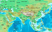
Asia (late 19th century- early 20th century).jpg 1,857 × 1,387; 773 KB
-
Asia 001ad.jpg 2,048 × 1,181; 751 KB
-
Asia 100bc.jpg 2,053 × 1,196; 760 KB
-
Asia 1025ad.jpg 1,939 × 1,176; 775 KB
-
Asia 1200ad.jpg 1,968 × 1,215; 731 KB
-
Asia 1300bc.jpg 2,007 × 1,125; 893 KB
-
Asia 200ad.jpg 1,910 × 1,209; 758 KB
-
Asia 200bc.jpg 2,037 × 1,191; 763 KB
-
Asia 323bc.jpg 2,040 × 1,169; 733 KB
-
Asia 400ad (cropped).jpg 754 × 633; 184 KB
-
Asia 400ad-kidarites.jpg 886 × 608; 326 KB
-
Asia 400ad.jpg 1,990 × 1,211; 790 KB
-
Asia 500ad.jpg 2,196 × 1,305; 435 KB
-
Asia 565ad.jpg 2,379 × 1,291; 448 KB
-
Asia 600ad 2.jpg 1,984 × 1,276; 963 KB
-
Asia 600ad.jpg 2,045 × 1,221; 811 KB
-
Asia 700ad (North central asia).jpg 715 × 398; 45 KB
-
Asia 700ad.jpg 1,953 × 1,166; 361 KB
-
Asia 800ad.jpg 2,099 × 1,215; 809 KB
-
Asia 900ad.jpg 2,222 × 1,518; 855 KB
-
Asoka Kaart.png 959 × 577; 15 KB
-
ATD of the regions of Turkey occupied by Russian troops during WW1.png 1,232 × 1,352; 191 KB
-
Athenian Empire in 445 BC according to the Tribute Lists.jpg 1,336 × 1,823; 1.5 MB
-
AtHistEur560.jpg 1,912 × 2,200; 667 KB
-
AtHistEur850.jpg 1,265 × 1,180; 260 KB
-
Atlantic-Wall-ko.jpg 612 × 804; 197 KB
-
Atlas-SeptMerveilleDuMondeAncien 1600.png 1,600 × 1,120; 1,009 KB
-
AtlBalk0.jpg 318 × 327; 156 KB
-
AtlBalk1730.jpg 318 × 327; 175 KB
-
AtlBalk1750.jpg 318 × 327; 179 KB
-
AtlBalk1850.jpg 318 × 327; 158 KB
-
AtlBalk1942.jpg 318 × 327; 141 KB
-
AtlBalk680.jpg 318 × 327; 155 KB
-
AtlBalk800.jpg 318 × 327; 166 KB
-
AtlBalk965.jpg 318 × 327; 174 KB
-
AtlBalkrelig.jpg 318 × 327; 173 KB
-
Australia 1851.png 646 × 594; 11 KB
-
Austria hungary 1911.gif 907 × 687; 397 KB
-
Austria1914physical.jpg 600 × 451; 408 KB
-
Autriche-hongrie2.PNG 805 × 553; 40 KB
-
Avance directo CE-2 ene 1935.jpg 1,128 × 798; 238 KB
-
Avars.png 1,202 × 514; 1.41 MB
-
Ayyubid.png 667 × 621; 37 KB
-
Azerbaijani khanates in the 18th-19th centuries.png 1,093 × 1,466; 541 KB
-
Aztec Empire c 1519.png 1,222 × 922; 433 KB
-
Aztec Empire.png 20,000 × 13,333; 7.88 MB
-
Aztecexpansion.png 1,892 × 1,055; 201 KB
-
Azuchimomoyama-japan.png 1,800 × 1,738; 978 KB
-
B Moresnet.png 419 × 559; 28 KB
-
B-29 targets from China.jpg 622 × 780; 190 KB
-
Bahri Dynasty 1250 - 1382 (AD).PNG 821 × 440; 36 KB
-
Bakker Schut-plan.PNG 664 × 466; 23 KB
-
Balkan union.png 627 × 600; 173 KB
-
Balkans 1815.png 1,000 × 1,000; 92 KB
-
Balkans map 1810.jpg 318 × 327; 153 KB
-
Baltic states borders.jpg 721 × 593; 219 KB
-
Baltic states borders.PNG 715 × 589; 498 KB
-
Baltikum 1686.png 885 × 700; 88 KB
-
Banatul la 1743.jpg 2,526 × 2,168; 2.45 MB
-
Banatul la 1774.jpg 2,526 × 2,168; 2.83 MB
-
Banovina of Croatia religious map.png 2,608 × 2,809; 335 KB
-
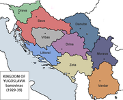
Banovina.png 750 × 600; 19 KB
-
Banovine Jugoslavia.png 407 × 331; 31 KB
-
Baroda-gujarat.png 748 × 611; 30 KB
-
Batalla de Brunete revisada.png 1,634 × 1,350; 951 KB
-
Battle of the Barents Sea.jpg 1,500 × 1,202; 264 KB
-
Baviera-Monaco & Baviera-Landshut.jpg 1,376 × 1,604; 171 KB
-
Bay of Bengal; Coromandel Coast and its colonial wars, c.1746-56.jpg 3,261 × 2,648; 1,011 KB
-
BeforeDayton.png 1,809 × 1,752; 160 KB
-
BeforeMithridaticWars.png 401 × 335; 50 KB
-
Bellbeaker map europe.jpg 650 × 597; 124 KB
-
Bellum1911.png 2,533 × 1,549; 476 KB
-
Benjamin of Tudela HE.jpg 1,151 × 618; 270 KB
-
Besitzungen der Markgrafschaft Baden-Baden in der Ortenau.png 444 × 236; 77 KB
-
Bevoelkerungsgruppen-Jugoslawien.png 700 × 700; 231 KB
-
Bih IEBLinRed.png 329 × 352; 23 KB
-
Bindusara mauryan empire (en).GIF 400 × 337; 11 KB
-
Bizonia.png 434 × 585; 36 KB
-
Black Drink map HRoe 2008.jpg 662 × 458; 335 KB
-
BMAC.png 450 × 335; 150 KB
-
Bocagenormandy.jpg 500 × 491; 60 KB
-
Bosna srebrena 1679.jpg 1,339 × 1,474; 177 KB
-
Boston annexation landfill.png 1,200 × 343; 31 KB
-
Brandenburg-Preußen1688.JPG 615 × 442; 69 KB
-
Bremer Staatsgebiet seit 1800.png 656 × 1,056; 33 KB
-
Britain.peoples.original.traditional.jpg 1,551 × 2,877; 571 KB
-
British America.png 383 × 329; 11 KB
-
British and French empires 1920.png 1,425 × 625; 40 KB
-
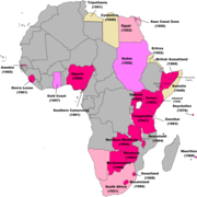
British Decolonisation in Africa.png 2,000 × 2,000; 406 KB
-
British Empire 1921 IndianSubcontinent.png 1,425 × 625; 39 KB
-
British Empire 1921.png 1,425 × 625; 58 KB
-
British Empire Anachronous 7.png 1,357 × 628; 48 KB
-
British Empire in 1959.png 1,425 × 625; 36 KB


