Category:Geology of Canada
Jump to navigation
Jump to search
overview of the geology of Canada | |||||
| Upload media | |||||
| Subclass of | |||||
|---|---|---|---|---|---|
| |||||
Subcategories
This category has the following 77 subcategories, out of 77 total.
*
+
A
B
C
- Core samples from Canada (1 F)
D
E
F
G
H
I
K
M
N
O
P
Q
R
S
- Speleology in Canada (3 F)
T
U
- Unconformities in Canada (5 F)
V
W
Media in category "Geology of Canada"
The following 37 files are in this category, out of 37 total.
-
2010 Mount Meager landslide seismic signals.png 742 × 602; 264 KB
-
Anticosti fossiles 001.jpg 4,032 × 3,024; 2.32 MB
-
Anticosti fossiles 006.jpg 4,032 × 3,024; 2.56 MB
-
Beechey Island 02 1997-08-02.jpg 1,573 × 1,071; 118 KB
-
Cadomin FM micro.JPG 2,228 × 1,656; 2.25 MB
-
Canadian Deposits of Uranium and Thorium 1962.pdf 895 × 1,418, 357 pages; 43.26 MB
-
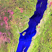
Charlevoix Meteorite Crater.jpg 250 × 250; 36 KB
-
On the geology of the Ottawa and Parry Sound railway (microform) (IA cihm 05238).pdf 804 × 1,264, 12 pages; 429 KB
-
The geological history of the Quebec group (microform) (IA cihm 07742).pdf 1,150 × 1,358, 23 pages; 1.1 MB
-
Circum-Superior Belt age map.jpg 550 × 288; 40 KB
-
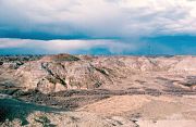
Dinosaur Park Fm.jpg 720 × 468; 279 KB
-
Dunvegan FM.JPG 347 × 284; 108 KB
-
Exploration drill cores (Potter Mine, east of Timmins, Ontario, Canada) (32928527137).jpg 2,532 × 3,790; 8.27 MB
-
Hannah Bay.jpg 4,127 × 4,096; 2.86 MB
-
Kaskapau-Pouce Coupe River.JPG 1,836 × 1,328; 1.66 MB
-
Montney FM.JPG 320 × 319; 111 KB
-
Mt sir douglas.jpg 1,600 × 1,200; 318 KB
-
Muskiki Shale.JPG 572 × 528; 138 KB
-
Muséum de Nantes - 607 - Apatite (Canada).jpg 4,272 × 2,848; 3.54 MB
-
Muséum de Nantes - 608 - Apatite (Canada).jpg 4,272 × 2,848; 4.92 MB
-
Muséum de Nantes - 609 - Apatite (Canada).jpg 4,272 × 2,848; 4.9 MB
-
MWH 4204.jpg 2,996 × 2,000; 4.43 MB
-
North america basement rocks.png 484 × 429; 31 KB
-
North Pit banded iron formation.jpg 604 × 453; 67 KB
-
ONTARIO SESSIONAL PAPERS, 1915, No.3-4 (1915) (14578540958).jpg 2,090 × 3,028; 705 KB
-
Pedersen og Pedersen 2012 side 4.png 1,100 × 936; 473 KB
-
Peicoast.jpg 2,848 × 2,136; 2.83 MB
-
PSM V67 D736 Geologizing on pine island.png 1,611 × 951; 347 KB
-
Riviere au Tonnerre 029.jpg 1,200 × 1,600; 661 KB
-
Sill Sainte Dorothee.jpg 2,048 × 1,536; 701 KB
-
St Mary River Fm Strata.jpg 4,000 × 3,000; 8.23 MB
-
The mountains of Atlantis sinking into a far sea.jpg 2,400 × 2,008; 2.56 MB


