Category:Altitude signs in Taiwan
Jump to navigation
Jump to search
Subcategories
This category has the following 3 subcategories, out of 3 total.
Media in category "Altitude signs in Taiwan"
The following 28 files are in this category, out of 28 total.
-
3150 above sea level sign at Songsyue Lodge under cloudy sky on 23 August 2017.jpg 5,184 × 3,456; 3.37 MB
-
Bagua Mountain elevation sign, as taken on 28 January 2021.jpg 3,000 × 4,000; 3.89 MB
-
Bike rider taking photo of Dayuling.jpg 4,912 × 2,760; 3.31 MB
-
County Highway 149A entering Caoling, on 5 October 2020.jpg 4,000 × 3,000; 5.93 MB
-
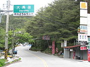
Dayuling.JPG 1,600 × 1,200; 387 KB
-
Guanyuan.JPG 1,600 × 1,200; 246 KB
-
Highway No.8 passing through Taroko.jpg 4,000 × 3,000; 5.25 MB
-
Longzitou Mountain elevation sign, as taken on 29 September 2021.jpg 3,000 × 4,000; 2.53 MB
-
Low angle view of the Paiyun Lodge.jpg 480 × 640; 262 KB
-
Luofu in Taiwan Provincial Highway 7.JPG 1,600 × 1,116; 388 KB
-
Paiyun Lodge name plate.jpg 1,280 × 853; 1.21 MB
-
Paiyun Lodge Notice Board.jpg 4,032 × 2,268; 4.98 MB
-
Paiyun Lodge plate 20080425.jpg 3,888 × 2,592; 3.68 MB
-
Place name sign of Luoshao on the Central Cross-Island Highway.jpg 4,912 × 2,760; 2.66 MB
-
Sign showing 29.3K and 3070M at Kunyang.jpg 5,184 × 3,456; 2.35 MB
-
Stele of Taiwan Datum Benchmark.JPG 3,000 × 4,000; 3.47 MB
-
Taiwan Datum Benchmark.JPG 4,000 × 3,000; 2.6 MB
-
Taiwan datum benchmark.jpg 3,264 × 1,840; 1.64 MB
-
Taiwan datum benchmark01.jpg 3,264 × 1,840; 1.69 MB
-
TW PHY20 Photo 01.JPG 450 × 600; 231 KB
-
Xue summit.jpg 5,456 × 3,632; 5.69 MB
-
Xueshan Summit.jpg 800 × 613; 90 KB
-
南投縣 台14甲線合歡山路牌 - panoramio.jpg 3,648 × 2,432; 725 KB
-
埡口標示 - panoramio.jpg 1,728 × 2,592; 1.37 MB
-
桃園北橫四稜.jpg 1,840 × 3,264; 1.71 MB
-
玉長隧道(長濱段) (2)Eastern entrance.jpg 3,264 × 2,448; 1.72 MB


