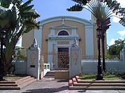
Bayamón, Puerto Rico
Jump to navigation
Jump to search
municipality in Puerto Rico | |||||
| Upload media | |||||
| Instance of | |||||
|---|---|---|---|---|---|
| Location | Puerto Rico, Caribbean | ||||
| Capital |
| ||||
| Inception |
| ||||
| Population |
| ||||
| Area |
| ||||
| Elevation above sea level |
| ||||
| Different from | |||||
| official website | |||||
 | |||||
-
Map of Puerto Rico highlighting Bayamón Municipality
-
subdivisions
-
aerial view of northern Bayamón with mogote formations of the Northern Karst Belt and mouth of the Bayamón River visible, 1999
-
Invención de la Santa Cruz Parish
-
Marqués de la Serna Bridge in Bayamón's City Center, built in 1869
-
Tren Urbano at Deportivo station
-
City Hall above Puerto Rico Highway 2
-
Puerto Rico National Cemetery
-
Bayamón Correctional Complex
-
Juan Ramón Loubriel Stadium
History
[edit]Main category: History of Bayamón, Puerto Rico
-
waterfront 1899
-
Postcard from 1903
-
Barker’s store inauguration at Plaza Río Hondo Mall in 1982.
-
Hurricane Maria relief efforts in Bayamón on Oct. 2017


