Template:Pl:Map Features:smoothness
Gładkość
| Key | Value | Element | Usable by | Description | Photo |
|---|---|---|---|---|---|
| smoothness | excellent | (thin_rollers) roller blade, skate board and all below | As-new asphalt or concrete, smooth paving stones with seamless connections, etc. | 
| |
| smoothness | good | (thin_wheels) racing bike and all below | Asphalt or concrete showing the first signs of wear, such as narrow (<1.5 cm) cracks, wider cracks filled up with tar, shallow dents in which rainwater may collect, etc. that may cause trouble for rollers but not for racing bikes. The best roads paved with bricks, sett, etc. also fall in this category. | 
| |
| smoothness | intermediate | (wheels) city bike, sport cars, wheel chair, Scooter and all below | Asphalt and equivalent that shows signs of maintenance such as patches of repaired pavement, wider cracks (>2 cm), etc. that may cause trouble for racing bikes. The pavement may contain potholes, but these are small, shallow (<3cm deep) and few so they are easily avoided, or the road shows damage due to subsidence (depressions of a scale >50 cm) or heavy traffic (shallow ruts in asphalt caused by trucks in summer). The quality of the surface starts to affect the speed of most passenger cars, so they will slow down to make the ride more comfortable (but still above 50% of the speed they would drive at if the road was smooth). The best unpaved but compacted roads fall in this category. | 
| |
| smoothness | bad | (robust_wheels) trekking bike, normal cars, Rickshaw and all below | Heavily damaged paved roads that badly need maintenance: many potholes, some of them quite deep. The average speed of cars is less than 50% of what it would be on a smooth road. However, it isn’t so rough that ground clearance becomes a problem. A ground clearance of a normal passenger car (>14 cm) is sufficient. Good unpaved roads without risk of damage to normal passenger cars are also included here. |  
| |
| smoothness | very_bad | (high_clearance) Car with high clearance, light-duty off road vehicles | Unpaved roads with potholes and ruts, but still passable with an average SUV with a ground clearance of at least 18 cm.* | 
| |
| smoothness | horrible | (off_road_wheels) heavy-duty off road vehicles and all below | Unpaved tracks with ruts, rocks etc that need a ground clearance of at least 21 cm (Toyota Landcruiser, Landrover, Lada Niva, bukhanka, etc.). Skid plate protection is advisable. | 
| |
| smoothness | very_horrible | (specialized_off_road_wheels) tractor, ATV, tanks, trial, Mountain bike and all kind of off-highway vehicles (see also mtb:scale=*) | Tracks with deep ruts and other obstacles that need a ground clearance of at least 24 cm. | 
| |
| smoothness | impassable | No wheeled vehicle | Ways, often highway=path, that are not passable by any vehicles, not even mountain bikes or specialised off-road vehicles, but are recognisable in the landscape and may still be useful for hikers. Consider also lifecycle prefixes disused:*=* or abandoned:*=* if the way used to be a passable road but has deteriorated. | 
|
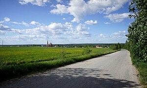
Please note: Photos are examples ONLY! The smoothness of a way should be assessed solely based on whether the way is usable by the vehicles mentioned above. A user of a certain road or path is only interested in whether the road can be driven or not. *Note that some unpaved tracks can be so steep that a car designed mostly for on-road use does not have the gear ratios and engine power needed to drive up a slope slow enough not to cause damage without the engine stalling. The track may still be smooth enough that such cars can drive down that slope without problem, so in such cases the track should be marked bad but the steep section tagged with incline=*.
This table is a wiki template with a default description in English. Editable here.
