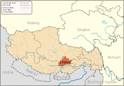
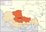
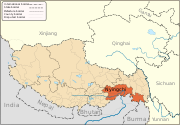
Fichier:Ngari map.svg

Taille de cet aperçu PNG pour ce fichier SVG : 800 × 557 pixels. Autres résolutions : 320 × 223 pixels | 640 × 446 pixels | 1 024 × 713 pixels | 1 280 × 892 pixels | 2 560 × 1 784 pixels | 1 520 × 1 059 pixels.
Fichier d’origine (Fichier SVG, nominalement de 1 520 × 1 059 pixels, taille : 189 kio)
Historique du fichier
Cliquer sur une date et heure pour voir le fichier tel qu'il était à ce moment-là.
| Date et heure | Vignette | Dimensions | Utilisateur | Commentaire | |
|---|---|---|---|---|---|
| actuel | 12 mars 2013 à 21:14 | 1 520 × 1 059 (189 kio) | Keithonearth | fixing Ngari/Shigatse prefecture boundary as pointed out by user:Fhah4 [http://en.wikipedia.org/w/index.php?title=Wikipedia:Graphics_Lab/Map_workshop&diff=541288793&oldid=541266575 here] | |
| 31 décembre 2008 à 06:04 | 1 520 × 1 059 (212 kio) | Keithonearth | Changing colour scheme to make more sense, progression from non-highlighted to most highlighted. Category:Tibet | ||
| 30 décembre 2008 à 03:17 | 1 520 × 1 059 (212 kio) | Keithonearth | {{Information |Description={{en|1=A map of the administrative boundaries of The Tibetan Autonomous Region with Nari (aka Ali) Prefecture highlighted.}} |Source=Own work by uploader |Author=Keithonearth |Date=2008-12-29 |Permission= | |
Utilisation du fichier
La page suivante utilise ce fichier :
Usage global du fichier
Les autres wikis suivants utilisent ce fichier :
- Utilisation sur bn.wikipedia.org
- Utilisation sur bo.wikipedia.org
- Utilisation sur cdo.wikipedia.org
- Utilisation sur da.wikipedia.org
- Utilisation sur en.wikipedia.org
- Ngari Prefecture
- Shiquanhe
- Rutog County
- Purang County
- Lumajangdong Co
- Template:Ngari Prefecture
- Coqên County
- Gar County
- Gê'gyai County
- Gertse County
- Zanda County
- Purang Town
- Coqên Town
- Rutog Town
- Demchok, Ngari Prefecture
- Tholing
- Minsar
- Zoco, Tibet
- Tsaparang
- Tholing Monastery
- Ngari Gunsa Airport
- Tegla Kar
- Orba Co
- Zhari Namco
- Dawa Lake
- Bangda Lake
- Guozha Lake
- Longmu Lake
- Chepzi
- Risum Township
- Tong Tso
- Wikipedia:Graphics Lab/Map workshop/Archive/Mar 2013
- Jaggang
- Tsosib Sumkyil Township
- Ngari Networking Project
- Shiquan River Sand Control Project
- Utilisation sur es.wikipedia.org
- Utilisation sur eu.wikipedia.org
- Utilisation sur fa.wikipedia.org
- Utilisation sur fi.wikipedia.org
- Utilisation sur hi.wikipedia.org
- Utilisation sur it.wikipedia.org
- Utilisation sur it.wikivoyage.org
- Utilisation sur pnb.wikipedia.org
- Utilisation sur pt.wikipedia.org
- Utilisation sur ru.wikipedia.org
Voir davantage sur l’utilisation globale de ce fichier.


