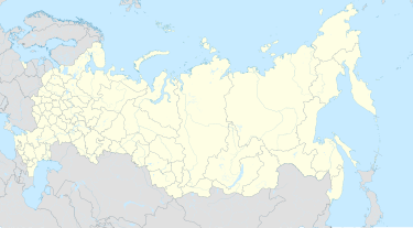
Vidyayevo
Vidyayevo
Видяево | |
|---|---|
Inhabited locality[1] | |
| Coordinates: 69°19′N 32°48′E / 69.317°N 32.800°E | |
| Country | Russia |
| Federal subject | Murmansk Oblast[1] |
| Founded | 1958 |
| Government | |
| • Mayor | S. Dubovoy |
| Elevation | 5 m (16 ft) |
| Population | |
| • Total | 5,771 |
| • Subordinated to | closed administrative-territorial formation of Vidyayevo[1] |
| • Capital of | closed administrative-territorial formation of Vidyayevo[1] |
| • Urban okrug | Vidyayevo Urban Okrug[3] |
| • Capital of | Vidyayevo Urban Okrug[3] |
| Time zone | UTC+3 (MSK |
| Postal code(s)[5] | 184372 |
| Dialing code(s) | +7 81553 |
| OKTMO ID | 47735000101 |
| Website | www |

Vidyayevo (Russian: Видя́ево) is a closed rural inhabited locality in Murmansk Oblast, Russia. Despite having a rural status, it is municipally incorporated as Vidyayevo Urban Okrug, as such status is the only one allowed by the federal law for closed inhabited localities. Population: 5,771 (2010 Census);[2] 6,307 (2002 Census).[6]
It is mostly known for the naval bases located in the Ara and Ura Bays. The locality itself is situated on the eastern side of the Ura Bay.
History
[edit]It was founded in 1958 as Uritsa (Урица), after the river flowing from Pityevoye Lake into the bay and providing drinking water for the settlement.[citation needed] Most likely, the name Uritsa is a Russian diminutive of Ura, which is a native Saami (Lappi) name for the bay and for a larger river Ura also feeding into the Ura Bay several kilometers away from Vidyayevo. Uritsa was renamed Vidyayevo in 1964 in honor of the World War II submarine commander Fyodor Vidyayev who perished in the Barents Sea in course of the military mission of the submarine ShcH-402 under his command.
Naval base
[edit]In the early 1960s, the area started serving as a base for diesel-powered submarines, and in 1979 nuclear-powered ones as well. In the 1980s, the base at Ara Bay was a relatively large one, serving submarines of all three generations. Remaining submarines in service in Ara Bay today are of the Akula (Shchuka-B), Sierra, and Oscar-II (Antey) class.
Vidyayevo (particularly the Ara Bay) was the home base of the now lost K-141 Kursk (which was an Oscar-II class). Naval radioactive waste storage facilities are located at the Ara Bay as well.
The base at Ura Bay is used for diesel submarines and a few smaller surface vessels. The settlement consists mostly of five-story apartment buildings built on granite rock foundations or on poles driven into permafrost.
Administrative and municipal status
[edit]Within the framework of administrative divisions, it is, together with another rural locality, incorporated as the closed administrative-territorial formation of Vidyayevo—an administrative unit with the status equal to that of the districts.[1] As a municipal division, the closed administrative-territorial formation of Vidyayevo is incorporated as Vidyayevo Urban Okrug.[3]
References
[edit]Notes
[edit]- ^ a b c d e Law #96-01-ZMO
- ^ a b Russian Federal State Statistics Service (2011). Всероссийская перепись населения 2010 года. Том 1 [2010 All-Russian Population Census, vol. 1]. Всероссийская перепись населения 2010 года [2010 All-Russia Population Census] (in Russian). Federal State Statistics Service.
- ^ a b c Law #530-01-ZMO
- ^ "Об исчислении времени". Официальный интернет-портал правовой информации (in Russian). June 3, 2011. Retrieved January 19, 2019.
- ^ Почта России. Информационно-вычислительный центр ОАСУ РПО. (Russian Post). Поиск объектов почтовой связи (Postal Objects Search) (in Russian)
- ^ Federal State Statistics Service (May 21, 2004). Численность населения России, субъектов Российской Федерации в составе федеральных округов, районов, городских поселений, сельских населённых пунктов – районных центров и сельских населённых пунктов с населением 3 тысячи и более человек [Population of Russia, Its Federal Districts, Federal Subjects, Districts, Urban Localities, Rural Localities—Administrative Centers, and Rural Localities with Population of Over 3,000] (XLS). Всероссийская перепись населения 2002 года [All-Russia Population Census of 2002] (in Russian).
Sources
[edit]- Мурманская областная Дума. Закон №96-01-ЗМО от 6 января 1998 г. «Об административно-территориальном устройстве Мурманской области», в ред. Закона №1953-01-ЗМО от 24 декабря 2015 г. «О внесении изменений в Закон Мурманской области "Об административно-территориальном устройстве Мурманской области"». Опубликован: "Мурманский Вестник", №10, стр. 3, 16 января 1998 г. (Murmansk Oblast Duma. Law #96-01-ZMO of January 6, 1998 On the Administrative-Territorial Structure of Murmansk Oblast, as amended by the Law #1953-01-ZMO of December 24, 2015 On Amending the Law of Murmansk Oblast "On the Administrative-Territorial Structure of Murmansk Oblast". ).
- Мурманская областная Дума. Закон №530-01-ЗМО от 2 декабря 2004 г. «О наделении статусом городского округа закрытых административно-территориальных образований Мурманской области», в ред. Закона №1812-01-ЗМО от 19 декабря 2014 г. «Об упразднении населённого пункта Мурманской области и о внесении изменений в отдельные законодательные акты Мурманской области». Вступил в силу 1 января 2005 г. Опубликован: "Мурманский Вестник", №234, стр. 3, 7 декабря 2004 г. (Murmansk Oblast Duma. Law #530-01-ZMO of December 2, 2004 On Granting Urban Okrug Status to the Closed Administrative-Territorial Formations of Murmansk Oblast, as amended by the Law #1812-01-ZMO of December 19, 2014 On Abolishing an Inhabited Locality in Murmansk Oblast and on Amending Various Legislative Acts of Murmansk Oblast. Effective as of January 1, 2005.).


