Penig
Appearance
Penig | |
|---|---|
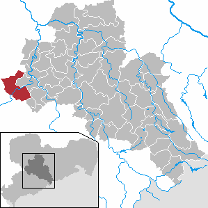
Location of Penig within Mittelsachsen district  | |
| Country | Germany |
| State | Saxony |
| Admin. region | Chemnitz |
| District | Mittelsachsen |
| Government | |
| • Mayor | Thomas Eulenberger (CDU) |
| Area | |
• Total | 63.31 km2 (24.44 sq mi) |
| Elevation | 208 m (682 ft) |
| Population (2022-12-31)[1] | |
• Total | 8,419 |
| • Density | 130/km2 (340/sq mi) |
| Time zone | UTC+01:00 (CET) |
| • Summer (DST) | UTC+02:00 (CEST) |
| Postal codes | 09322 |
| Dialling codes | 037381 |
| Vehicle registration | FG |
| Website | www.penig.de |
Penig (German pronunciation: [ˈpeːnɪç]) is a town in the district of Mittelsachsen, in the Free State of Saxony, Germany. It is situated on the river Zwickauer Mulde, 19 km northwest of Chemnitz. Penig housed a concentration camp during World War II.
References
- ^ "Einwohnerzahlen nach Gemeinden als Excel-Arbeitsmappe" (XLS) (in German). Statistisches Landesamt des Freistaates Sachsen. 2024.
