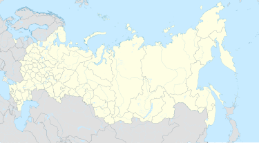
Arkhara
Appearance
Arkhara
Архара | |
|---|---|
Settlement[1] | |
| Coordinates: 49°25′00″N 130°05′00″E / 49.41667°N 130.08333°E | |
| Country | Russia |
| Federal subject | Amur Oblast[1] |
| Founded | 1911 |
| Elevation | 161 m (528 ft) |
| Population | |
• Total | 9,585 |
| • Subordinated to | Arkharinsky District[1] |
| Time zone | UTC+9 (MSK+6 |
| Postal code(s)[4] | 676740–676742 |
| OKTMO ID | 10605151051 |
Arkhara (Russian: Архара́) is an Urban-type settlement and the administrative center of the Arkharinsky District in Amur Oblast, Russia. It is located at the junction of the Transbaikal Railway and the Far Eastern Railway. The Arkhara River flows near the town. Population: 9,585 (2010 Census);[2] 10,847 (2002 Census);[5]
Climate
| Climate data for Arkhara (1991–2020, extremes 1936–present) | |||||||||||||
|---|---|---|---|---|---|---|---|---|---|---|---|---|---|
| Month | Jan | Feb | Mar | Apr | May | Jun | Jul | Aug | Sep | Oct | Nov | Dec | Year |
| Record high °C (°F) | −4.9 (23.2) |
4.2 (39.6) |
19.8 (67.6) |
30.5 (86.9) |
34.1 (93.4) |
37.1 (98.8) |
35.7 (96.3) |
34.1 (93.4) |
31.6 (88.9) |
27.0 (80.6) |
14.3 (57.7) |
2.6 (36.7) |
37.1 (98.8) |
| Mean daily maximum °C (°F) | −18.1 (−0.6) |
−11.7 (10.9) |
−1.4 (29.5) |
10.9 (51.6) |
19.4 (66.9) |
24.3 (75.7) |
26.9 (80.4) |
24.9 (76.8) |
19.1 (66.4) |
9.3 (48.7) |
−5.2 (22.6) |
−16.7 (1.9) |
6.8 (44.2) |
| Daily mean °C (°F) | −24.9 (−12.8) |
−19.4 (−2.9) |
−8.4 (16.9) |
4.4 (39.9) |
12.6 (54.7) |
18.1 (64.6) |
21.4 (70.5) |
19.2 (66.6) |
12.3 (54.1) |
2.8 (37.0) |
−11.1 (12.0) |
−23.0 (−9.4) |
0.3 (32.6) |
| Mean daily minimum °C (°F) | −31.3 (−24.3) |
−27.2 (−17.0) |
−15.9 (3.4) |
−1.8 (28.8) |
5.7 (42.3) |
12.1 (53.8) |
16.4 (61.5) |
14.1 (57.4) |
6.3 (43.3) |
−3.0 (26.6) |
−16.6 (2.1) |
−28.9 (−20.0) |
−5.8 (21.5) |
| Record low °C (°F) | −47.3 (−53.1) |
−43.9 (−47.0) |
−37.1 (−34.8) |
−20.8 (−5.4) |
−9.3 (15.3) |
−0.8 (30.6) |
3.2 (37.8) |
2.6 (36.7) |
−7.9 (17.8) |
−26.2 (−15.2) |
−38.5 (−37.3) |
−44.8 (−48.6) |
−47.3 (−53.1) |
| Average precipitation mm (inches) | 9 (0.4) |
7 (0.3) |
14 (0.6) |
34 (1.3) |
66 (2.6) |
93 (3.7) |
143 (5.6) |
129 (5.1) |
74 (2.9) |
38 (1.5) |
19 (0.7) |
15 (0.6) |
641 (25.3) |
| Source: Pogoda.ru.net[6] | |||||||||||||
References
Notes
- ^ a b c Law #10-4765
- ^ a b Russian Federal State Statistics Service (2011). Всероссийская перепись населения 2010 года. Том 1 [2010 All-Russian Population Census, vol. 1]. Всероссийская перепись населения 2010 года [2010 All-Russia Population Census] (in Russian). Federal State Statistics Service.
- ^ "Об исчислении времени". Официальный интернет-портал правовой информации (in Russian). 3 June 2011. Retrieved 19 January 2019.
- ^ Почта России. Информационно-вычислительный центр ОАСУ РПО. (Russian Post). Поиск объектов почтовой связи (Postal Objects Search) (in Russian)
- ^ Federal State Statistics Service (21 May 2004). Численность населения России, субъектов Российской Федерации в составе федеральных округов, районов, городских поселений, сельских населённых пунктов – районных центров и сельских населённых пунктов с населением 3 тысячи и более человек [Population of Russia, Its Federal Districts, Federal Subjects, Districts, Urban Localities, Rural Localities—Administrative Centers, and Rural Localities with Population of Over 3,000] (XLS). Всероссийская перепись населения 2002 года [All-Russia Population Census of 2002] (in Russian).
- ^ "Погода и Климат – Климат Архары" (in Russian). Weather and Climate (Погода и климат). Retrieved 17 November 2023.
Sources
- Амурский областной Совет народных депутатов. Закон №127-ОЗ от 23 декабря 2005 г. «О порядке решения вопросов административно-территориального устройства Амурской области», в ред. Закона №272-ОЗ от 11 ноября 2013 г. «О внесении изменений в Закон Амурской области "О порядке решения вопросов административно-территориального устройства Амурской области"». Вступил в силу со дня первого официального опубликования, за исключением подпункта "б" пункта 2 статьи 7, вступающего в силу с 1 января 2006 г. Опубликован: "Амурская правда", №11, 24 января 2006 г. (Amur Oblast Council of People's Deputies. Law #127-OZ of December 23, 2005 On the Procedures of Handling the Issues of the Administrative and Territorial Structure of Amur Oblast, as amended by the Law #272-OZ of November 11, 2013 On Amending the Law of Amur Oblast "On the Procedures of Handling the Issues of the Administrative and Territorial Structure of Amur Oblast". Effective as of the day of the first official publication, with the exception of subitem "b" of item 2 of Article 7, which is effective January 1, 2006.).
- Амурский областной Совет народных депутатов. Закон №91-ОЗ от 18 ноября 2005 г. «Об установлении границ и наделении соответствующим статусом муниципального образования Архаринского района и муниципальных образований в его составе», в ред. Закона №63-ОЗ от 30 июня 2008 г «Об объединении Грибовского и Могилевского сельсоветов в Архаринском районе и внесении изменений в Закон Амурской области "Об установлении границ и наделении соответствующим статусом муниципального образования Архаринского района и муниципальных образований в его составе"». Вступил в силу со дня первого официального опубликования. Опубликован: "Амурская правда", №236, 2 декабря 2005 г. (Amur Oblast Council of People's Deputies. Law #91-OZ of November 18, 2005 On Establishing the Borders of and Granting a Corresponding Municipal Formation Status to Arkharinsky District and the Municipal Formations Which It Comprises, as amended by the Law #63-OZ of June 30, 2008 On the Merger of Gribovsky and Mogilevsky Selsoviets in Arkharinsky District and on Amending the Law of Amur Oblast "On Establishing the Borders of and Granting a Corresponding Municipal Formation Status to Arkharinsky District and the Municipal Formations Which It Comprises". Effective as of the day of the first official publication.).


