Category:Sinkholes
Zur Navigation springen
Zur Suche springen
Català: Dolina o bòfia
Deutsch: Doline oder Erdfall
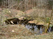
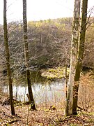
English: A sinkhole, also known as a sink, shake hole, swallow hole, swallet, doline or cenote, is a natural depression or hole in the surface topography caused by the removal of soil or bedrock, often both, by water
Español: Dolinas o sumideros
Français : Dolines
Ελληνικά: Καταβόθρα
schlot-, trichter- oder schüsselförmige Senke der Erdoberfläche | |||||
| Medium hochladen | |||||
| Unterklasse von | |||||
|---|---|---|---|---|---|
| Ist Teil von | |||||
| Eventuell gleichwertig | Erdfall | ||||
| |||||
See also: Category:Ponors for other similar karst formations.
See also: Category:Potholes for 'sinkholes' in streets.
Unterkategorien
Es werden 16 von insgesamt 16 Unterkategorien in dieser Kategorie angezeigt:
In Klammern die Anzahl der enthaltenen Kategorien (K), Seiten (S), Dateien (D)
Seiten in der Kategorie „Sinkholes“
Diese Kategorie enthält nur die folgende Seite.
Medien in der Kategorie „Sinkholes“
Folgende 118 Dateien sind in dieser Kategorie, von 118 insgesamt.
-
21 - Карстовая воронка на Пулатхане.JPG 1.600 × 1.200; 1,06 MB
-
A caver descending Death's Heads Hole entrance shaft.JPG 2.664 × 3.000; 2,85 MB
-
Al Malek 3813-3815mod.jpg 3.940 × 2.188; 7,33 MB
-
Al Malek 3830-3831mod.jpg 3.835 × 1.760; 6,19 MB
-
Al Malek 3833-3837mod.jpg 5.544 × 2.464; 11,77 MB
-
Al Malek 3857-3858mod.jpg 3.920 × 1.773; 6,24 MB
-
Al Malek P1013843mod.jpg 2.560 × 1.338; 3,72 MB
-
Amarsinghchowk.jpg 2.322 × 4.128; 2,88 MB
-
Andutz dolina 02.jpg 4.608 × 3.456; 6,15 MB
-
The Sink hole, Orlando, Florida (NYPL b11707410-G90F134 034ZF).tiff 3.072 × 2.008; 17,65 MB
-
The Sink hole, Orlando, Florida (NYPL b11707410-G90F134 035ZF).tiff 3.072 × 2.035; 17,89 MB
-
Big Sinkhole P1013633mod.jpg 2.560 × 1.710; 4 MB
-
Buraco das Araras Jardim MS Brazil.jpg 1.920 × 1.214; 3,32 MB
-
CarholeJustin.jpg 800 × 511; 467 KB
-
Catigbian 1 earthquake.JPG 1.944 × 2.592; 2,18 MB
-
CNX Chem 14 00 Sinkhole.jpg 1.300 × 538; 1,86 MB
-
Conca di Orlek.jpg 3.072 × 2.304; 3,2 MB
-
Cover-collapse sinkhole.png 715 × 212; 243 KB
-
Cover-subsidence sinkhole.png 720 × 219; 269 KB
-
Crater carril auxiliar vista hermosa - panoramio.jpg 1.600 × 1.200; 786 KB
-
Crater on Mëisules Gherdëina.JPG 4.288 × 2.848; 7,23 MB
-
Dillsgraben Panoramabild 2017.07.19-1.jpg 9.771 × 1.984; 4,94 MB
-
Dissolution sinkhole.png 532 × 223; 185 KB
-
Dolin-bildung.jpg 464 × 309; 20 KB
-
Dolina andutz.jpg 4.608 × 3.456; 6,1 MB
-
Doline Dachstein Plateau 2018.jpg 3.000 × 4.000; 5,05 MB
-
Dolinenfeld Zainingen-Donnstetten Schwaebische-Alb.jpg 1.800 × 1.200; 1,56 MB
-
Dolinenkarte des Kreises Karapınar.png 2.342 × 2.102; 4,96 MB
-
Dunst Namibia Oct 2002 slide233.jpg 6.816 × 4.464; 2,05 MB
-
Dunst Namibia Oct 2002 slide234.jpg 6.820 × 4.464; 1,9 MB
-
Dunst Namibia Oct 2002 slide237.jpg 6.808 × 4.464; 1,89 MB
-
Dutovlje Slovenia - sinkhole.JPG 2.646 × 1.982; 2,35 MB
-
Dürrenstein Niederösterreich 03.JPG 1.747 × 1.310; 719 KB
-
East North Avenue at Greenmount Avenue in Baltimore, MD, July 2022 at site of sinkhole.jpg 3.024 × 4.032; 1,31 MB
-
Estavela radensko polje.jpg 1.024 × 683; 401 KB
-
FEMA - 32288 - FEMA worker looks at a Sink Hole in a road from flood.jpg 3.687 × 2.400; 6,45 MB
-
Flooded sinkhole in nature and landscape complexes "Uroczysko Buczyna".png 4.032 × 3.024; 36,34 MB
-
Geological report on Monroe County, Michigan (1900) (14785843333).jpg 2.686 × 1.744; 711 KB
-
Gouffre de Padirac 1 Luc Viatour.jpg 1.944 × 2.592; 1,83 MB
-
Grand Gulf cave 1-02Aug07.jpg 1.728 × 2.592; 1,43 MB
-
Hakata sinkhole 20161109.jpg 960 × 1.280; 368 KB
-
Hersfeld kathus seeloch.jpg 3.164 × 1.042; 975 KB
-
Initial-stage-of-sinkhole-at-El-Trbol.jpg 2.353 × 1.395; 1,52 MB
-
Jandourkovy závrty 1.jpg 800 × 600; 132 KB
-
Jandourkovy závrty 2.jpg 800 × 600; 122 KB
-
KarstterrainUSGS.jpg 1.313 × 585; 273 KB
-
Katavothra Peloponnese.jpg 1.600 × 1.067; 2,02 MB
-
Kuala Lumpur sinkhole footage.jpg 295 × 171; 8 KB
-
LeonSinksGeologicalArea02.jpg 1.024 × 683; 534 KB
-
Lit up tomo in Ruakuri Cave.jpg 4.160 × 6.240; 11,67 MB
-
LIYKA~18.JPG 1.200 × 1.600; 390 KB
-
Mardelle2.jpg 841 × 323; 77 KB
-
Maujahn-Lage.png 857 × 840; 79 KB
-
Meteorologische Messstation Gruenloch.jpg 2.592 × 1.944; 1,78 MB
-
Moosloch Norschwaben.JPG 2.304 × 1.704; 920 KB
-
Mosul Dam sinkhole.jpg 865 × 665; 77 KB
-
Niubizidong Tiankeng in the snow.jpg 3.264 × 2.448; 1,97 MB
-
O'Leno State Park Santa Fe River obs deck01.jpg 3.264 × 2.448; 2,95 MB
-
Otjikoto Lake.jpg 1.000 × 633; 234 KB
-
Pakihi Stream runs into sinkhole.JPG 4.000 × 3.000; 6,06 MB
-
PikiWiki Israel 14532 Dead Sea sinkholes.jpg 2.592 × 1.944; 3,37 MB
-
Pozzo del Merro sinkhole - 1999 dive exploration 01.jpg 504 × 612; 530 KB
-
Pozzo del Merro sinkhole - 1999 dive exploration 02.jpg 732 × 516; 550 KB
-
Pozzo del Merro sinkhole - aerial view.jpg 720 × 516; 644 KB
-
Pozzo del Merro sinkhole - cross-section view.png 552 × 756; 93 KB
-
Pulo Altamura.jpg 7.536 × 2.460; 8,2 MB
-
RakovSkocjan2.jpg 1.200 × 1.600; 1,14 MB
-
River Monterroso sinkhole.png 4.464 × 1.668; 9,22 MB
-
Rowton Pot entrance.jpg 2.848 × 2.136; 1,54 MB
-
Rumbling hole entrance rigging.jpg 2.848 × 2.136; 1,45 MB
-
Sanspareil Wasserloch.jpg 2.560 × 1.920; 2,25 MB
-
Schneetälchen Doline Totes Gebirge 20080728.jpg 3.872 × 2.592; 7,6 MB
-
Schwimmende Insel.jpg 2.304 × 3.072; 4,25 MB
-
Sinkhole in gryke Carletonville, Gauteng Province.jpg 640 × 430; 112 KB
-
Sinkhole in parking lot.jpg 3.264 × 2.448; 3,59 MB
-
Sinkhole on a road.jpg 300 × 214; 13 KB
-
Sinkhole on the old Saida route.webm 1 min 5 s, 352 × 640; 30,79 MB
-
Sinkhole Orjen.jpg 799 × 1.204; 141 KB
-
Sinkhole-col-tn2.jpg 2.041 × 1.533; 834 KB
-
Sinkhole-col-tn3.jpg 2.041 × 1.533; 1,05 MB
-
Site of the 2024 Kuala Lumpur sinkhole 01.jpg 3.456 × 3.456; 1,54 MB
-
Site of the 2024 Kuala Lumpur sinkhole 02.jpg 4.160 × 2.340; 829 KB
-
Site of the 2024 Kuala Lumpur sinkhole 03.jpg 4.160 × 2.340; 934 KB
-
Site of the 2024 Kuala Lumpur sinkhole 04.jpg 4.160 × 2.340; 965 KB
-
Site of the 2024 Kuala Lumpur sinkhole 05.jpg 4.160 × 2.340; 842 KB
-
Site of the 2024 Kuala Lumpur sinkhole 06.jpg 4.160 × 2.340; 831 KB
-
Site of the 2024 Kuala Lumpur sinkhole 07.jpg 4.160 × 2.340; 810 KB
-
Site of the 2024 Kuala Lumpur sinkhole 08.jpg 4.160 × 2.340; 843 KB
-
Site of the 2024 Kuala Lumpur sinkhole 09.jpg 3.456 × 3.456; 933 KB
-
Site of the 2024 Kuala Lumpur sinkhole 10.jpg 1.280 × 1.280; 196 KB
-
Site of the 2024 Kuala Lumpur sinkhole 11.jpg 2.560 × 1.440; 329 KB
-
Site of the 2024 Kuala Lumpur sinkhole 12.jpg 4.160 × 2.340; 814 KB
-
Site of the 2024 Kuala Lumpur sinkhole 13.jpg 2.560 × 1.440; 352 KB
-
Site of the 2024 Kuala Lumpur sinkhole 14.jpg 2.560 × 1.440; 324 KB
-
Site of the 2024 Kuala Lumpur sinkhole 15.jpg 4.160 × 2.340; 906 KB
-
Site of the 2024 Kuala Lumpur sinkhole 16.jpg 3.456 × 3.456; 1.006 KB
-
Site of the 2024 Kuala Lumpur sinkhole 17.jpg 3.456 × 3.456; 1,08 MB
-
Site of the 2024 Kuala Lumpur sinkhole 18.jpg 3.456 × 3.456; 682 KB
-
Site of the 2024 Kuala Lumpur sinkhole 19.jpg 3.456 × 3.456; 831 KB
-
Site of the 2024 Kuala Lumpur sinkhole 20.jpg 3.456 × 3.456; 833 KB
-
Sri Lanka river.jpg 720 × 405; 109 KB
-
Steinernes-Meer Karsthoehle.jpg 768 × 1.024; 252 KB
-
Suffosion sinkhole Dinarids Mt Orjen leg P.Cikovac.jpg 4.032 × 3.024; 7,29 MB
-
Tarnowskie Góry ul. Teofila Królika - czwarte zapadlisko.jpg 3.120 × 4.160; 3,32 MB
-
Togolilo sinkhole, Rove Peninsula, Fiji.jpg 2.048 × 1.536; 1,4 MB
-
Traina Sinkhole north-west of Khawr al Udayd.jpg 1.634 × 1.087; 206 KB
-
Trockene Riesendoline bei Çıralı (Karapinar, Provinz Konya).jpg 4.752 × 3.168; 6,85 MB
-
Two suffosion sinkholes at the Velika Jastrebica 1865 m a.s.l on Orjen leg P.Cikovac.jpg 7.757 × 3.913; 33,63 MB
-
View up a tomo in Ruakuri Cave.jpg 3.264 × 4.896; 5,89 MB
-
WinkSink1.JPG 2.848 × 2.136; 2,9 MB
-
Zavrt1.jpg 1.930 × 1.321; 1,59 MB
-
זוג בולענים בשמורת עין גדי - ים המלח.jpg 3.889 × 2.918; 6,37 MB
-
“Leocrain Thunderbolt Saves public”.jpg 2.224 × 1.347; 695 KB
-
三门海1.jpg 670 × 448; 131 KB
-
三门海2.jpg 670 × 445; 82 KB


