Category:Hautacam
Zur Navigation springen
Zur Suche springen
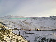
English: Hautacam is a ski resort in the Pyrenees. It is situated in the Hautes-Pyrénées department, in the Midi-Pyrénées region. The winter sports station lies at a height of 1560 meters. In road bicycle racing, the ascent to Hautacam is known as a tough climb, featuring many times in the Tour de France.
Français : Hautacam est une station de sports d'hiver des Pyrénées françaises située dans le département des Hautes-Pyrénées en région Midi-Pyrénées à proximité d'Argelès-Gazost et de Lourdes.
französisches Skigebiet | |||||
| Medium hochladen | |||||
| Ist ein(e) | |||||
|---|---|---|---|---|---|
| Ort | Beaucens, Kanton Argelès-Gazost, Département Hautes-Pyrénées, Okzitanien, Metropolitan-Frankreich, Frankreich | ||||
| Gebirgszug | |||||
| Höhe über dem Meeresspiegel |
| ||||
| offizielle Website | |||||
 | |||||
Medien in der Kategorie „Hautacam“
Folgende 36 Dateien sind in dieser Kategorie, von 36 insgesamt.
-
Alpages Hautacam 65.jpg 2.592 × 1.944; 2,18 MB
-
AsCy Hautacam 10.jpg 2.592 × 1.944; 2,21 MB
-
AsCy Hautacam 11.jpg 2.592 × 1.944; 2,27 MB
-
AsCy Hautacam 12.jpg 2.592 × 1.944; 2,11 MB
-
AsCy Hautacam 4.jpg 2.592 × 1.944; 1,22 MB
-
AsCy Hautacam- virage Arrioutou.jpg 2.592 × 1.944; 2,18 MB
-
Biz09 25.jpg 1.440 × 661; 117 KB
-
Bruyères Hautacam.jpg 5.152 × 3.864; 8,42 MB
-
Hautacam 65 VA.jpg 2.592 × 1.944; 2,12 MB
-
Hautacam août 2019.jpg 5.152 × 3.864; 5,8 MB
-
Hautacam en été 1.jpg 5.152 × 3.864; 4,59 MB
-
Hautacam en été 2.jpg 5.152 × 3.864; 4,49 MB
-
Hautacam en été 3.jpg 5.152 × 3.864; 5,34 MB
-
Hautacam en été 4.jpg 5.152 × 3.864; 3,94 MB
-
Hautacam en été 5.jpg 3.864 × 5.152; 3,92 MB
-
Hautacam en été 6.jpg 5.152 × 3.864; 4,34 MB
-
Hautacam en été.jpg 5.152 × 3.864; 3,86 MB
-
Hautacam vaches.jpg 5.152 × 3.864; 5,26 MB
-
La station de ski Hautacam (dep.65).jpg 2.048 × 1.536; 625 KB
-
Le Hautacam, restaurant de la station de ski de Hautacam.jpg 2.048 × 1.536; 489 KB
-
Le tapis de Hautacam.jpg 2.048 × 1.536; 559 KB
-
Montagnes vues du col d'Hautacam.jpg 5.152 × 3.864; 4,24 MB
-
Panneau AS Hautacam dernier km.jpg 2.592 × 1.944; 1,19 MB
-
Panneau AS Hautacam km 3.jpg 2.592 × 1.944; 1,22 MB
-
Paysage depuis le col de Moulata.jpg 3.456 × 2.304; 2,88 MB
-
Pista fondo.jpg 2.272 × 1.704; 675 KB
-
Piste Les marmottes avec le teleski du Cardouet à gauche.jpg 2.048 × 1.536; 610 KB
-
Pistes Hautacam été.jpg 2.592 × 1.944; 2,1 MB
-
Refuge Tramassel- Hautacam.jpg 2.592 × 1.944; 2,01 MB
-
Station Hautacam 65.jpg 2.592 × 1.944; 2,08 MB
-
Station Hautacam.jpg 5.152 × 3.864; 4,5 MB
-
Stats G panneau Tramassel.jpg 2.592 × 1.944; 1,17 MB
-
Tablou de iarnă 01.jpg 4.160 × 3.120; 3,6 MB
-
Tablou de iarnă 02.jpg 4.160 × 3.120; 3,18 MB
-
Tablou de iarnă 03.jpg 4.160 × 3.120; 3,43 MB


