Category:Guthram Gowt
Jump to navigation
Jump to search
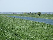
English: Guthram Gowt is a small settlement between Bourne and Spalding in Lincolnshire, England, at a bend in the River Glen.
human settlement in United Kingdom | |||||
| Upload media | |||||
| Instance of | |||||
|---|---|---|---|---|---|
| Location |
| ||||
 | |||||
Media in category "Guthram Gowt"
The following 17 files are in this category, out of 17 total.
-
Drainage Farm - geograph.org.uk - 472962.jpg 640 × 427; 51 KB
-
Engine peninsula-Guthram Gowt-geograph-1788314-by-Bob-Harvey.jpg 4,000 × 3,000; 2.84 MB
-
Engine peninsula-Guthram Gowt-geograph-1788354-by-Bob-Harvey.jpg 3,792 × 2,368; 1.56 MB
-
Grange Farm - geograph.org.uk - 472964.jpg 640 × 427; 61 KB
-
Guthram Gowt.jpg 640 × 480; 76 KB
-
Guthram-Gowt-North-flowing drain to bridge.jpg 4,000 × 3,000; 2.96 MB
-
Ironbar Drove - geograph.org.uk - 1565843.jpg 640 × 426; 69 KB
-
Ironbar Drove - geograph.org.uk - 472944.jpg 640 × 427; 70 KB
-
Marshy Land near Willow Tree Farm - geograph.org.uk - 436756.jpg 640 × 477; 83 KB
-
Marshy Land near Willow Tree Farm - geograph.org.uk - 436758.jpg 640 × 477; 85 KB
-
Owl box on River Glen floodbank - geograph.org.uk - 436762.jpg 477 × 640; 41 KB
-
Rain Gauge-Guthrum Gowt-Geograph-1788375-by-Bob-Harvey.jpg 2,952 × 1,472; 1.92 MB
-
Rain hut-Guthram Gowt-geograph-1788334-by-Bob-Harvey.jpg 4,000 × 3,000; 3.05 MB
-
RiverGlenGuthramGowt.jpg 2,272 × 1,704; 883 KB
-
Straight Track - geograph.org.uk - 418603.jpg 640 × 480; 79 KB


