Puyehue (Vuikan)
Erscheinungsbild
| Puyehue | ||
|---|---|---|
 Da Puyehue vom westle glenga Lago Puyehue aus gseng. | ||
| Häh | 2236 m | |
| Log | Región de Los Ríos, Chile | |
| Beag | Anden | |
| Geographische Log | 40° 35′ 25″ S, 72° 7′ 2″ W | |
|
| ||
| Typ | Schichtvuikan | |
| Lezde Eruption | 4. Juni 2011 | |
 Eruption vom Puyehue am 9. Juni 2011 | ||
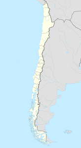
Da Puyehue is a 2236 m houa Vuikan a de siadchilenischn Andn und ghead zum Vuikankomplex Puyehue-Cordón Caulle. Er is a da Región de Los Ríos, 20 Kilomeda estle vom Lago Puyehue am 107 km2 groußn Puyehue-Nationalpark.
Lidaradua
[Werkeln | Am Gwëntext werkeln]- Teresa Moreno, Wes Gibbons: The geology of Chile. Geological Society of America, 2007
- O. Oncken: The Andes: active subduction orogeny. Springer, 2006
- Suzanne Mahlburg Kay, Victor A. Ramos: Field trip guides to the backbone of the Americas in the Southern and Central Andes. Geological Society of America, 2008
Im Netz
[Werkeln | Am Gwëntext werkeln]- Puyehue-Cordón Caulle im Global Volcanism Program der Smithsonian Institution (englisch)
- Puyehue (Vuikan) im Global Volcanism Program der Smithsonian Institution (englisch)
- Beschreibung in andeshandbook.org (spanisch).
- The Atlantic, Artikel zur Eruption 2011 mit Photos (englisch)
- NASA: Spur der Aschewolken bei ihrer Weltumrundung
